This mountain is EVERYWHERE in Japan: Ha-yama
むらやま はやま

村山葉山
MURAYAMA HA-YAMA
Former Dewa Sanzan peak in inland Yamagata Prefecture with an extensive Shugendo and Mountain Worship history.
Skip to My Hiking Guide to Murayama Ha-yama
The Japanese affinity for mountains stretches much further than their (valid, mind you) infatuation with Fuji-san. I mean, just look at the sheer number of words for mountain in Japanese:
- Yama (山, e.g. Fuji-yama), is probably the most well-known term for mountain in Japanese. Yama can also be read as san (e.g. Haguro-san), and sometimes voiced as zan, (e.g. Chokai-zan).
- Then there are terms like mine (峰, also 峯 and 嶺, e.g. Kumanonaga-mine), for peak, also read ho, and sometimes fu or pu.
- Take (嶽, or its simplified version 岳, e.g. Shojiga-take), voiced as dake (e.g. Atsumi-dake), or also read as Gaku, means ‘a tall and precipitous mountain’.
- Plus, I’ve recently discovered many cases of mori (森), usually meaning forest, also meaning mountain, e.g. Futatsu-mori or Kagikake-mori).
- Now, here I’m getting a bit picky, but there is also ten, (巓 e.g. Higashidai-ten), which refers specifically to a summit, rather than the mountain as a whole.
But wait, there’s more!
Better still, Japanese even has different terms for mountains dependent entirely on their proximity to civilisation. That these terms exist is a clear remnant of a time when mountains in Japan were much more than objects of adoration, when mountains in Japan provided sustenance for the population:
- Mountains alongside villages are Satoyama (里山), village mountains.
- Okuyama (奥山), mountains in the depths (not to be confused with ‘deep mountains’), describe mountains far from human settlements.
- In addition, mountains simply far off in the distance are known as Miyama or Shinzan (深山), deep mountains (not to be confused with ‘mountains in the depths’).
- Then, we also have Reizan(霊山), sacred or holy mountains. Reizan are the mountains our souls are said to ascend when we pass away, and are where us yamabushi (mountain ascetics) train. Reizan include locations such as Dewa Sanzan, Yoshino-yama, or Japan’s “Three Holy Mountains (三霊山, Sanreizan)”; Fuji-san, Tate-yama, and Haku-san.
But wait, there’s even more! The Most Common Name for a Mountain in Japan
To make things even more interesting, there’s one name for a mountain that appears a lot more than any other in Japan. It’s a name that proves Japan’s relationship with mountains is unlike anywhere else, and it’s a name that in most likelihood you’ve never heard of:
Ha-yama.
Ha-yama are so common, in fact, Yamagata Prefecture alone has at least four; Murayama Ha-yama, Okitama Ha-yama, Ha-yama in Kaminoyama City, and Ha-yama in Yonezawa. Fukushima Prefecture has at least two, Ha-yama in Koriyama, and Ha-yama in Date City. There is a Ha-yama in Kesennuma, Miyagi Prefecture, and of course Iwate Prefecture gets in on the action too.
But why so many?
The name Ha-yama should give us a hint as to why it is so common, right?
Well, yes and no.
Firstly, there are so many ways for writing Ha-yama (葉山, 羽山, 巴山, 端山, 麓山), it’s hard to know where to start.
But the thing is, although Ha-yama often have different Kanji characters, these readings are all variations of the same character, 端, Haji, ‘edge’.
In the same vain, Ha-yama all have one characteristic that links them; They are either located on the edge of Reizan, sacred or holy mountains, or are at least nearby.
In other words, Ha-yama are all ‘edge’ mountains. Ha-yama is a category of mountains in and of itself, while also being a name. Hence, the frequency.
What makes Ha-yama ‘edge mountains’ so special?
As you’re aware, Japan is a country with a long history and culture of ancestor worship. The Japanese do a good job of remembering that without the ancestors, none of us would be here.
Take Obon (Bon festival), for example.
The custom of Obon is a time when Japanese people welcome the spirits of the ancestors back into their homes and villages.
Back to from where, though?
Why, the mountains, of course.

During Obon, it’s not uncommon to see Mukaebi (“welcoming fire”) or Okuribi (“sending fire”) outside houses, or even a giant 大 (big) character burning on the hillside. These fires are lit to guide the ancestral spirits down from the mountains back to the homes of their descendants.
Like the Mukaebi and Okuribi, fires, at Obon, it’s common to see horses made from cucumbers, and cows made from eggplants. These symbolise the vessels the ancestral spirits use to come and go from the descendants’ homes, respectively.
Horses are obviously very fast, so the spirits ride horses to get back to their homes as soon as possible. And could you imagine riding a cow (like Isabella Bird did) to get up a mountain? Cows purposely slow down the return journey, meaning we get to enjoy more time in the presence of the ancestors, before they return to their abode in the mountains.
So, what’s the connection to Ha-yama?
Well, when we pass away, it’s believed our souls do their own form of spiritual training on the mountains (see my article on Gassan for more). Under the guidance of 13 Buddha, our souls first climb the low-lying Satoyama (village mountains) nearby. Our souls then venture up to the mid-height mountains, a job Ha-yama are perfectly poised for.
Eventually, after 33 years, it’s believed our souls make their way to the summit of the taller Reizan (holy mountains). Here our souls turn into kami (deities) that protect all of us down below.
And here’s the important part
There is a deep-seated belief in Japan that ancestral souls that are prayed to turn into kami that bring good fortune. At the same time, ancestral souls that aren’t prayed to turn into kami that bring bad fortune. This is exactly why we yamabushi pray for the souls of the ancestors lost to natural disasters, those without families left to pray for them like the victims of The Great East Japan Earthquake.
Obon works as an annual reminder for us to pay our respects to the souls of the deceased. On the other hand, Ha-yama are a constant reminder.
Therefore, Ha-yama play a critical role in not only reminding us of the importance of praying to the ancestors while also playing a critical role in the afterlife. Ha-yama are therefore not the tallest mountains around, which is probably why you haven’t heard of them, nor are they the shortest, meaning there are quite a few.
But they are certainly one of the most important.
So, what’s it like on Ha-yama? Let’s find out, with my local Ha-yama, Murayama Ha-yama, right next to Gassan of the Dewa Sanzan.
Murayama Ha-yama: A Former Dewa Sanzan Mountain?
Murayama Ha-yama (not to be confused with Okitama Ha-yama) lies right next to the Dewa Sanzan, the three sacred mountains of Dewa in Yamagata prefecture. An important part of the journey our souls take before reaching the summit of the looming Gassan, Murayama Ha-yama also has an interesting backstory in and of itself.
In truth, Murayama Ha-yama had been on my bucket list even before I started the 100 Famous Mountains of Yamagata project. Although these days Murayama Ha-yama is just a regular ‘edge mountain’, in the past it was a Dewa Sanzan peak.
The Shugendo History of Murayama Ha-yama
With a Shugendo history dating back to the Nara Period (710–784), along with Haguro-san and Gassan, up until the Edo perido (1603-1868), Murayama Ha-yama formed the three Dewa Sanzan peaks. At that time, Yudono-san was the Oku-no-in (inner sanctuary), rather than one of the three mountains itself.
Traditionally, worshippers would climb Haguro-san, Murayama Ha-yama, and Gassan. Then, and only then would they go on to Yudono-san, and emerge feeling as if they have received a new life (so-called ‘rebirth’). With all that in mind, allow me to share with you my experience climbing Murayama Ha-yama, the ‘edge mountain’ of the Dewa Sanzan.
Hiking Murayama Ha-yama
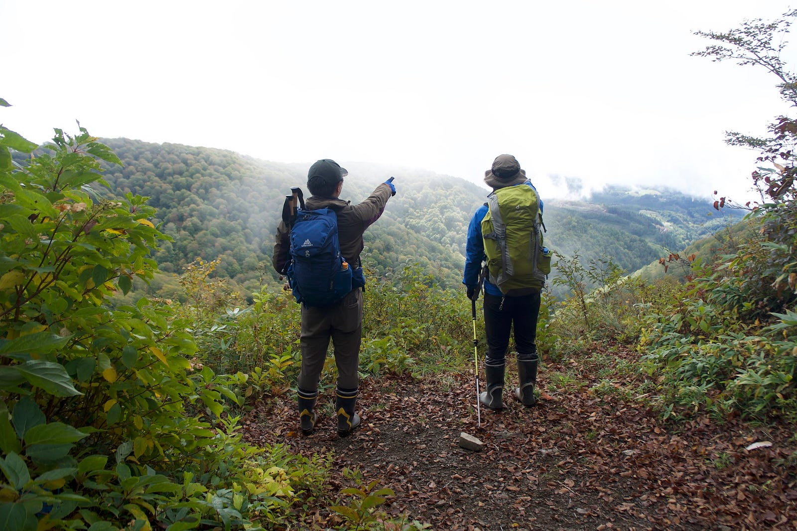
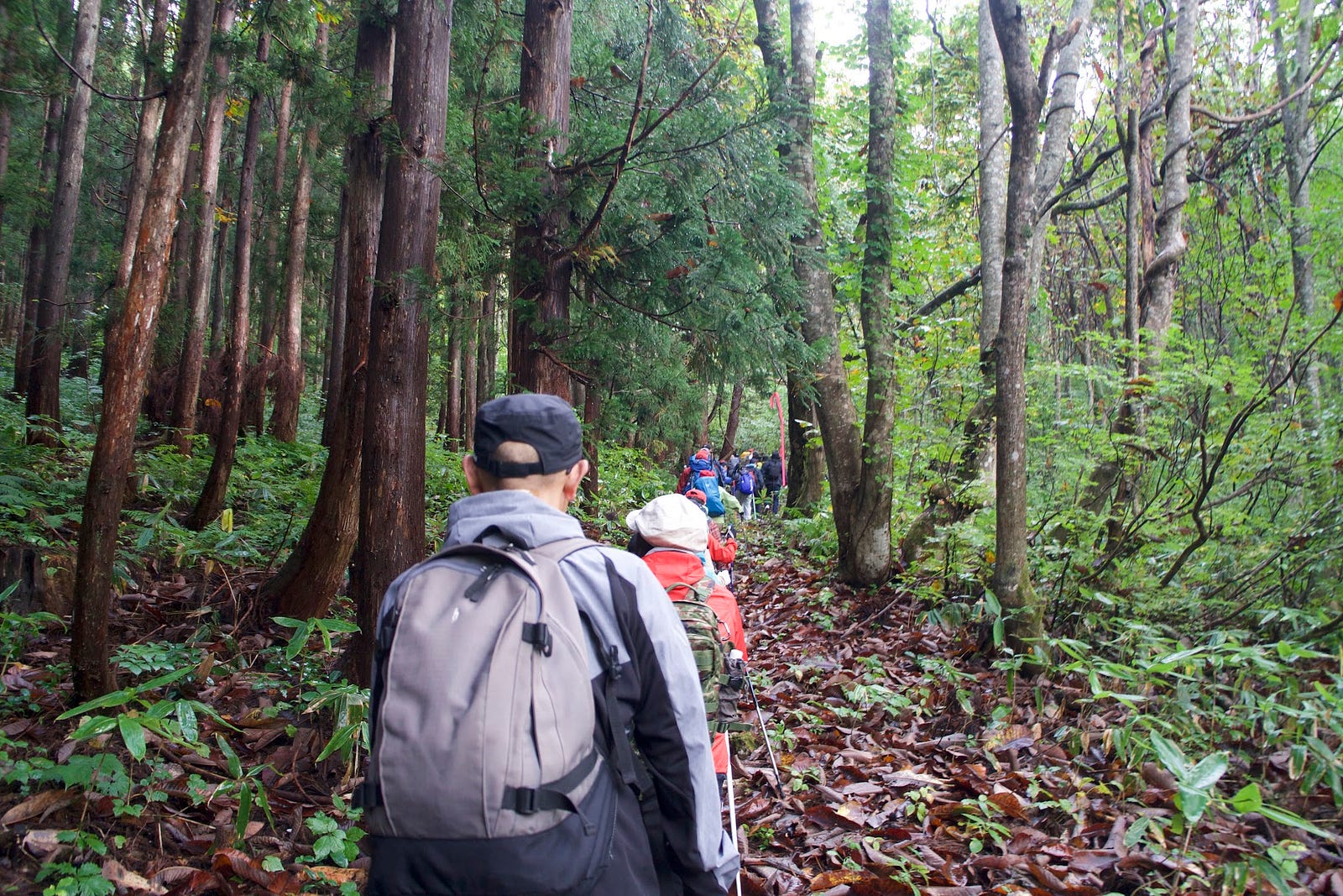
When I arrived at the trailhead to Murayama Ha-yama, I had no idea what to expect. For one thing, one of the grandmothers was adamant that I had to hear about her knack for finding edible mushrooms, and the glorious feast she made for her husband just the night before.
Or take, for example, the bunch of elementary school boys on an excursion for their volleyball club. Rather than climbing mountains, these boys seemed more obsessed with the catchphrases of recently deceased professional wrestler Antonio Inoki, spending much of the hike shouting ‘Genki desu ka?’ and ‘ichi, ni, san, daa!’ at the top of their lungs.
Then of course there were our guides for the day, the Sagae Alpine Club. This well-experienced bunch of hikers, none younger than 70, featured members who had climbed K2 and even Everest before. Needless to say, I was in good company, and looking forward to a day of autumn leaves, alpine shrines, and the spectacular vistas of Murayama Ha-yama.
Murayama Ha-yama Location
Murayama Ha-yama lies in three municipalities; Sagae and Murayama Cities, and the town of Okuramura, home to Hijiori Onsen. However, as the only 100 Famous Mountain of Yamagata in Sagae City, and since I was invited to climb by Matsuda-san of Sagae City, credit needs to go to them (right?).
Known for the astonishing greenery of summer, and the changing leaves of autumn, Murayama Ha-yama is also famous as the only mountain from where all six of Yamagata Prefecture’s 100 Famous Mountains of Japan are visible (Chokai-zan, Gassan, Zao-san, Ide-san, Nishiazuma-yama and Oasahi-dake).
The Extinct Volcano of Murayama Ha-yama
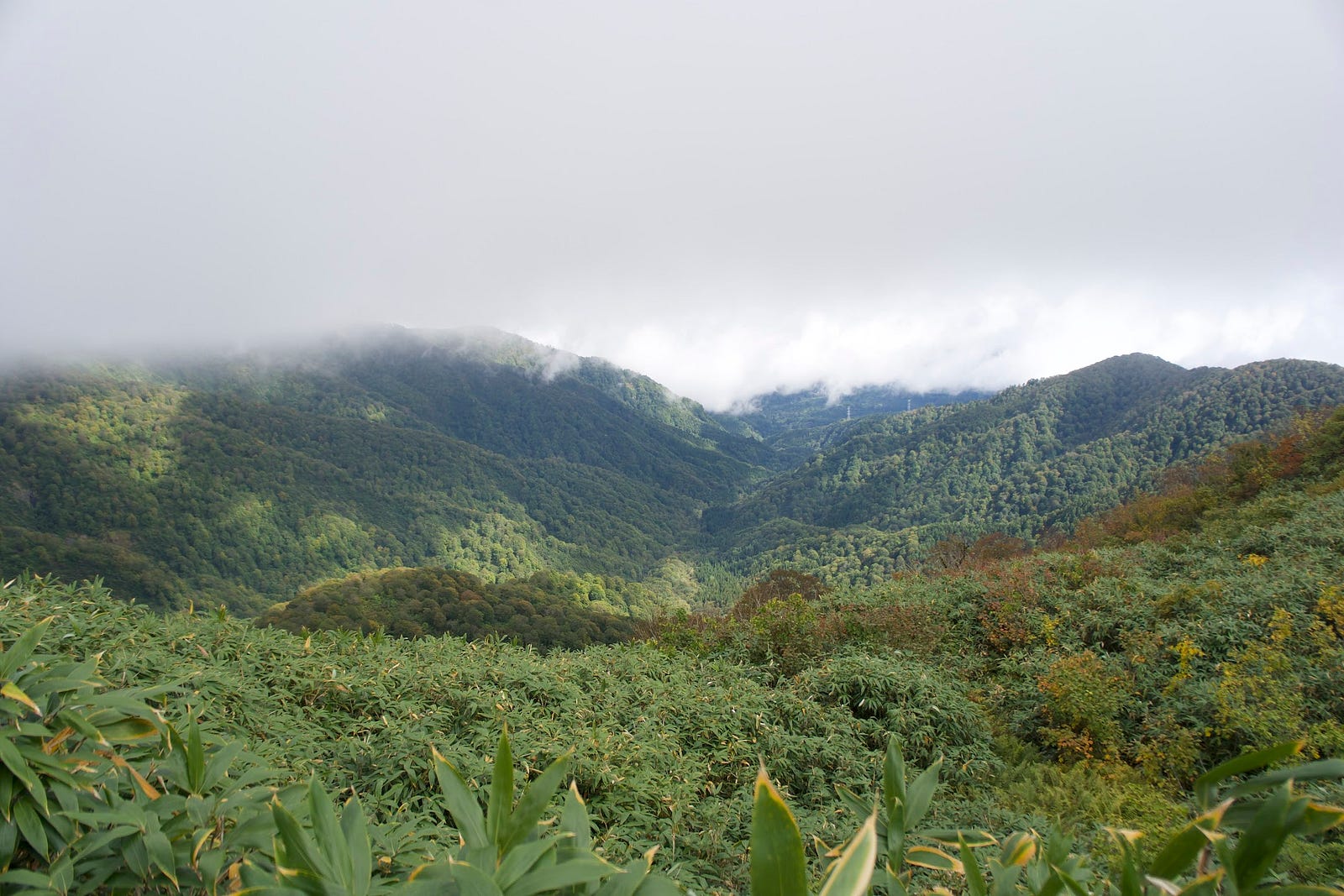
Becoming increasingly evident as you walk the trails, Murayama Ha-yama is an extinct volcano. On one side of the mountain, we find the bountiful rice fields and rivers of inland Yamagata Prefecture. The surrounding landscape is dotted with numerous hamlets that eventually merge into the sprawling metropolises of Obanazawa, Higashine, Tendo, Yamagata, and Sagae. Cities that are themselves surrounded by mountains.
On the other side of the ridge, the cliffs fall sharply in a distinct cone shape, with nothing but forest and the occasional mountain stream to break up the monotony. Then, if you let your eye follow the crater rim around to the west, in the distance you see it; Murayama Ha-yama’s Oku-no-in inner sanctuary, Hakuban Jinja. Murayama Ha-yama itself is believed to be the Kami of crops, an object of mountain worship (sangake suhai) prayed to for an abundant harvest for millennia. This alone was why large numbers visited the peak since ancient times.
Murayama Ha-yama’s Flora and Fauna
Murayama Ha-yama boasts beech forests near the summit. There are also rare alpine flowers such as Ranzania (Togakushishoma), Enkianthus campanulatus (Sarasadodan), Hakusan Rhododendron (Hakusanshakunage), and avens (Chinguruma). Avens are designated prefectural natural monuments. Raccoon dogs, Japanese marten, Asian black bears, and civets also reside on the mountain.
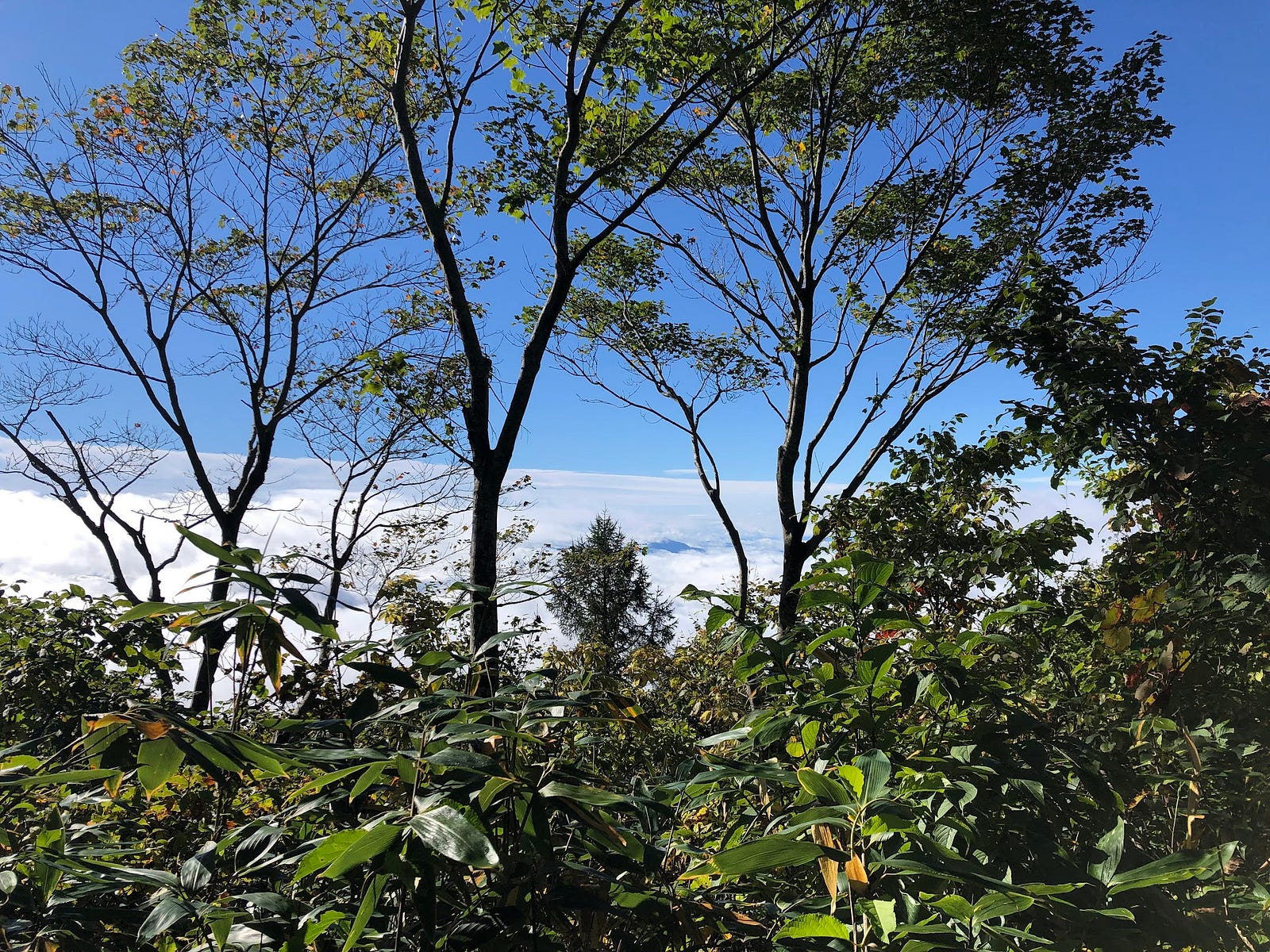
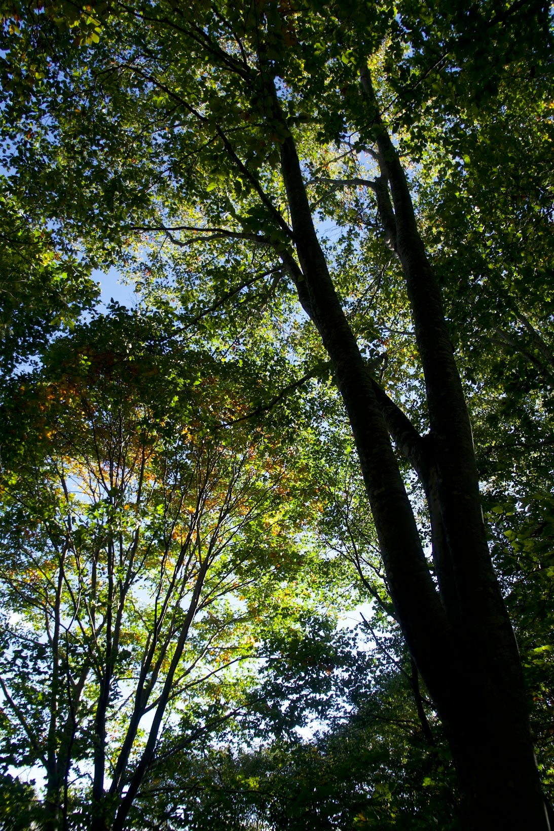
Luckily, or not, we didn’t come across any of these animals on our hike. However, we did get to bask in the glory of the autumn leaves. Much like on the epitome of autumn leaves, Taizo-san, autumn is the best time of year in Japan. Climbing Murayama Ha-yama in October only proves my point.
Bring your own Bottle
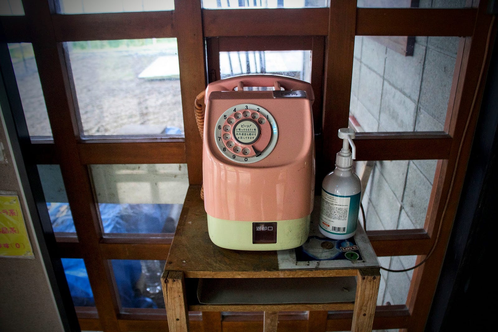
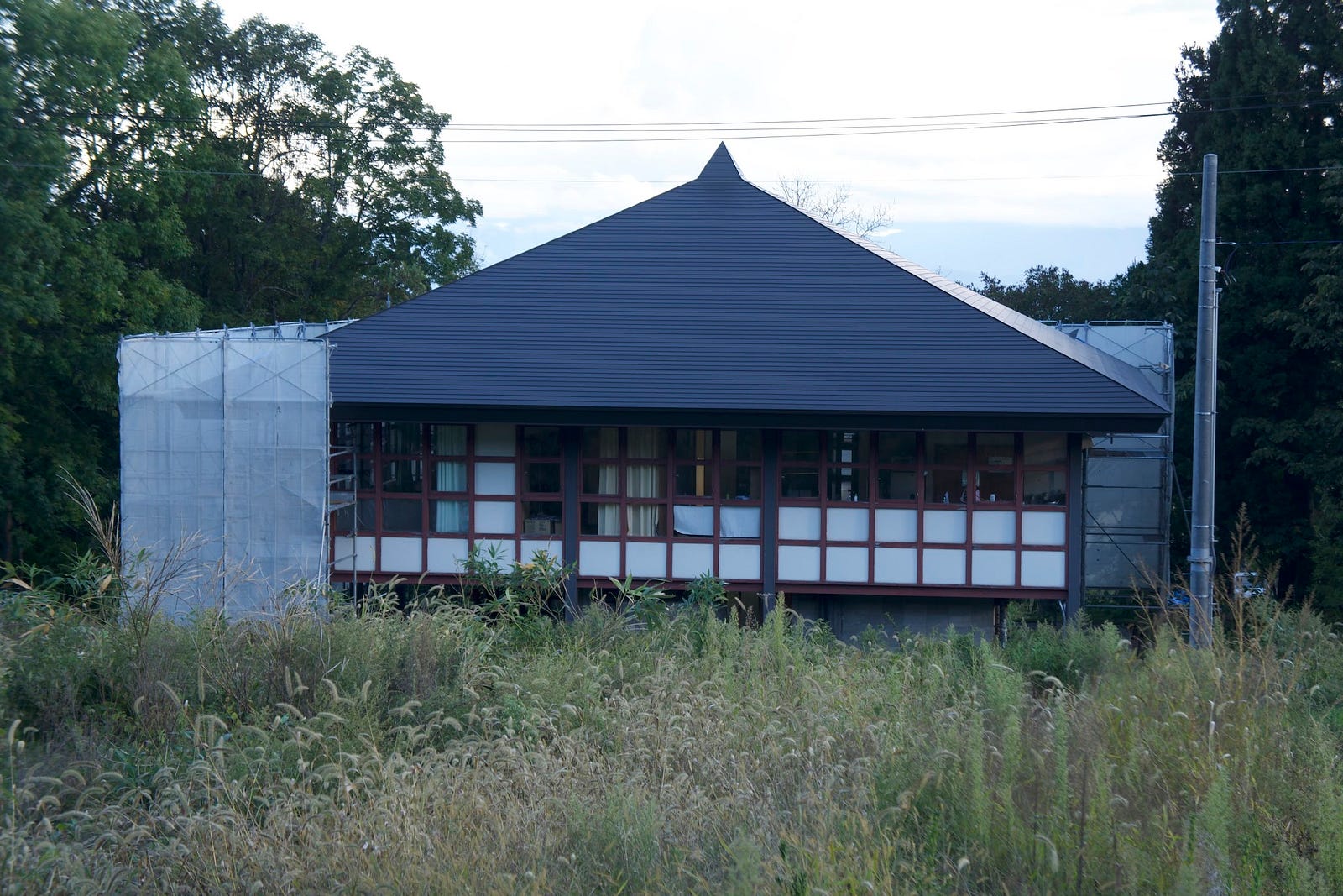
The hike up The Hata Trail starts at the Ha-yama Shimin-so, a purpose-built hut for visitors to the mountain. When you come, bring empty drink bottles. Rght in front of the Ha-yama Shimin-so is a water spring called Chomei-sui, the spring of longevity. This water comes straight from the source, it just doesn’t get fresher than that.
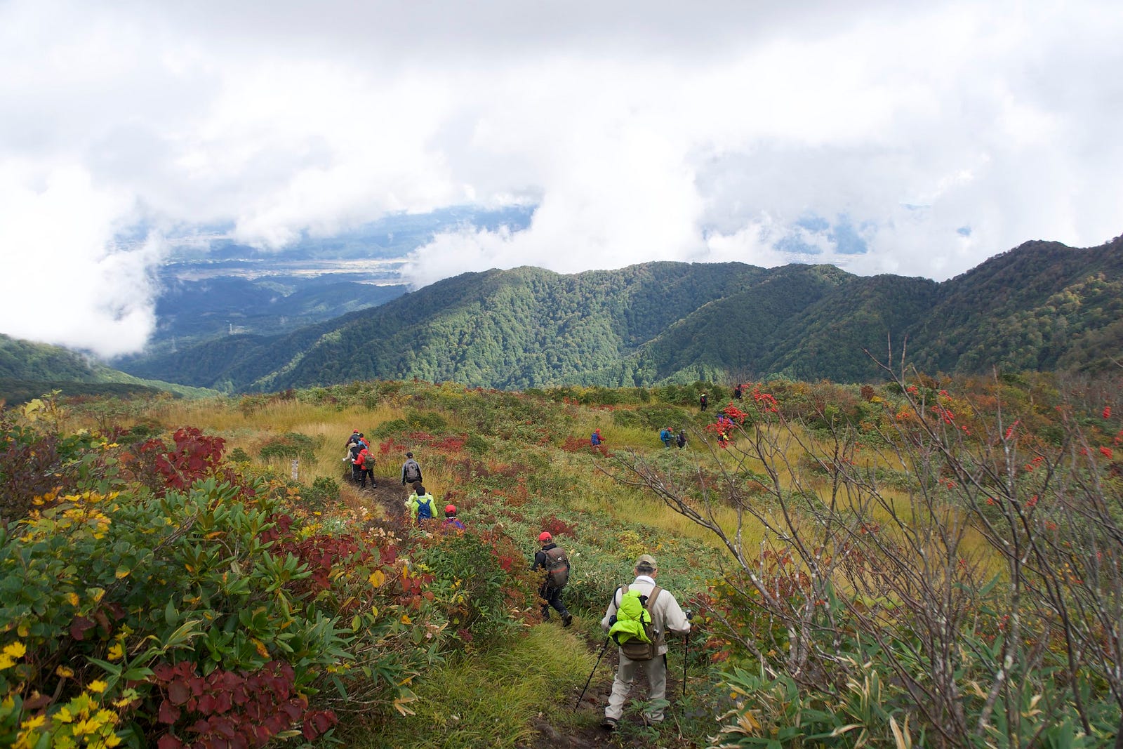
From the Shimin-so, the trail first goes through a deep cedar forest. Keep on going up the steep slopes and eventually the forest changes to a combination of beech and larch. Along the way there are a few lookouts, and eventually you will come out at Hanabatake, the field of flowers. This is Murayama Ha-yama’s main ridge, and where we meet the Iwano and Shamu trails.
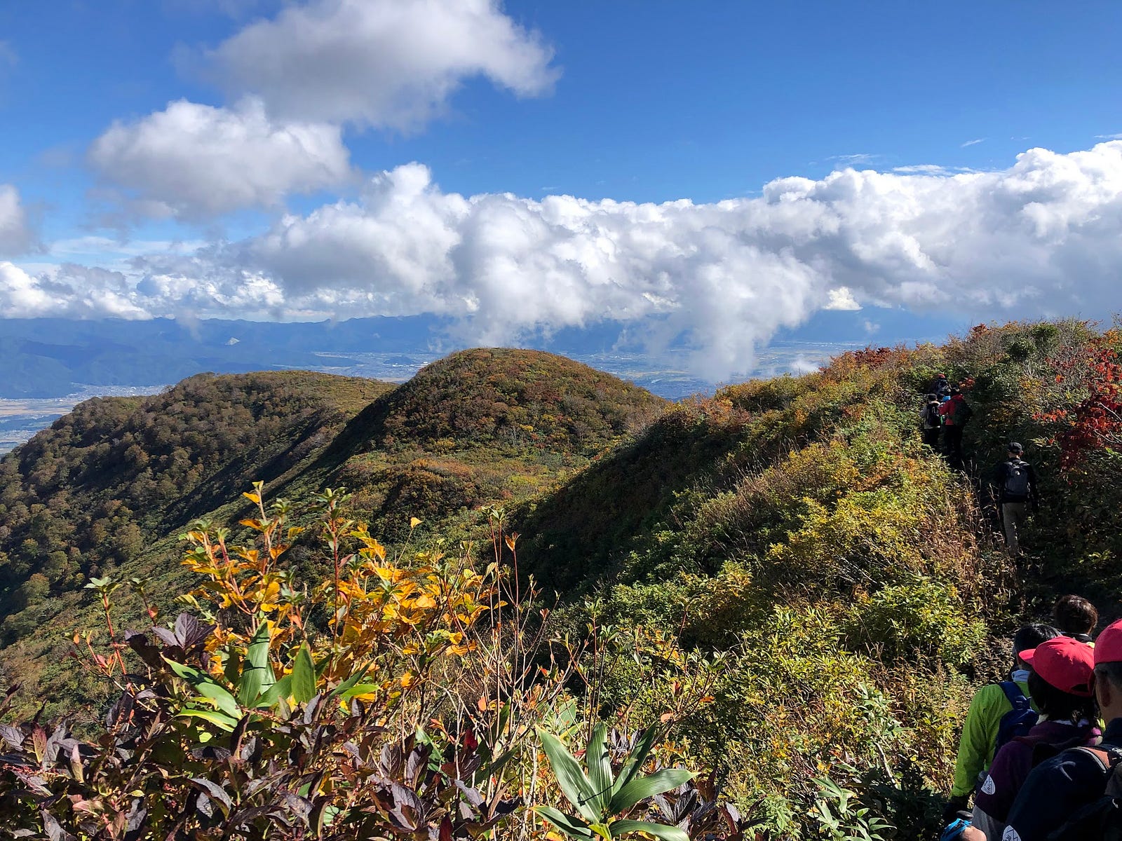
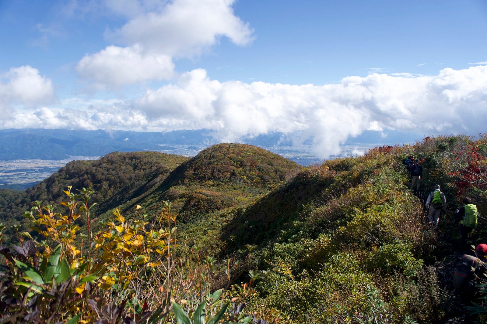
The Volcanic Ridge of Murayama Ha-yama
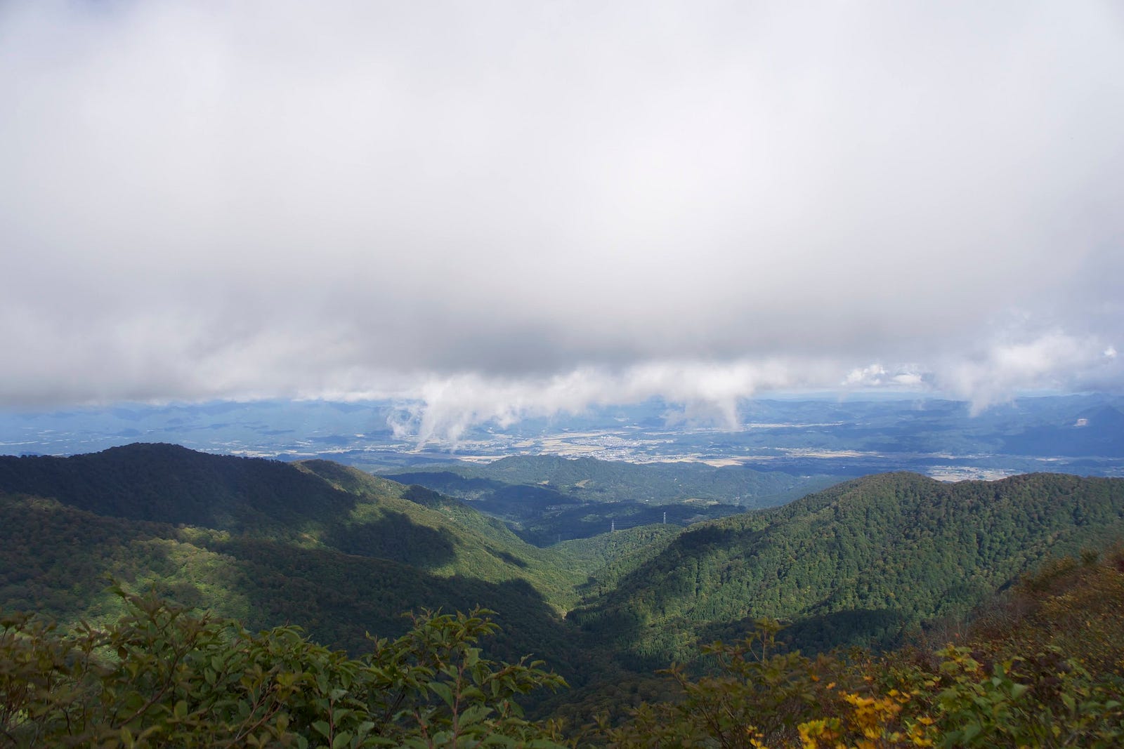
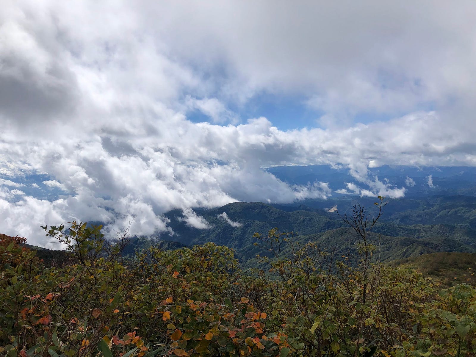
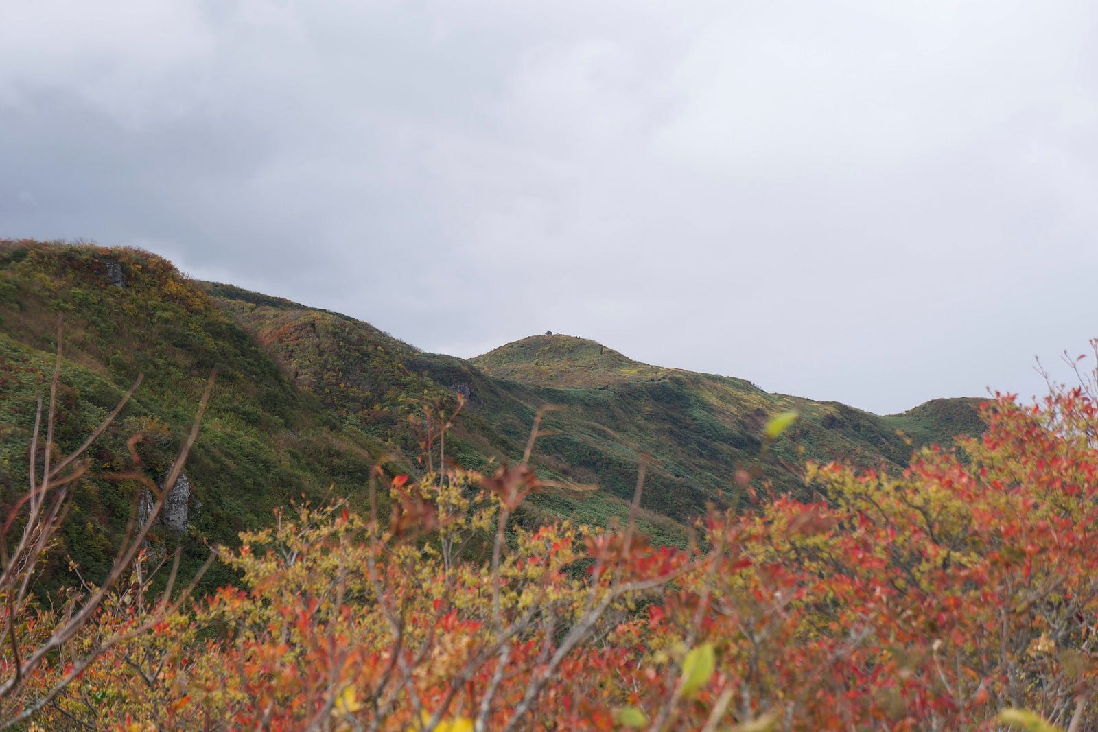
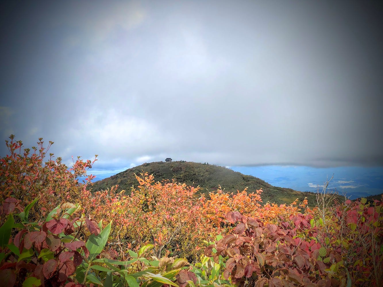
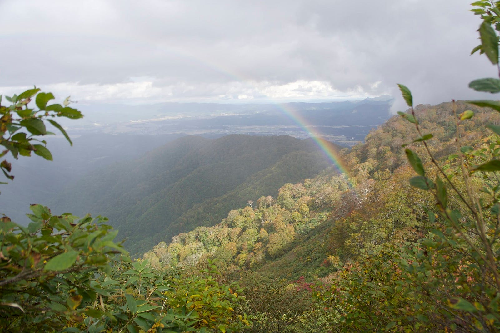
The ridge is where the fact that Murayama Ha-yama was a volcano is extremely evident. Look into the centre and you can see a clear cone full of forests and mountain streams. Look out, and you can see inland Yamagata, and in the distance, many of the other mountains of Yamagata prefecture. In the distance, it’s also possible to catch a glimpse of the small Hakuban Jinja, our destination.
Follow the ridge around to the left. Go up and over Ko-mori first, and then O-mori, two of the peaks of Murayama Ha-yama. The steep rocks and ropes of Ko-mori and O-mori proved a little challenging for our elementary-aged friends. However, they all made a valiant effort and were able to get past, albeit with a few scratches and bruises. It’s all part of the experience though!
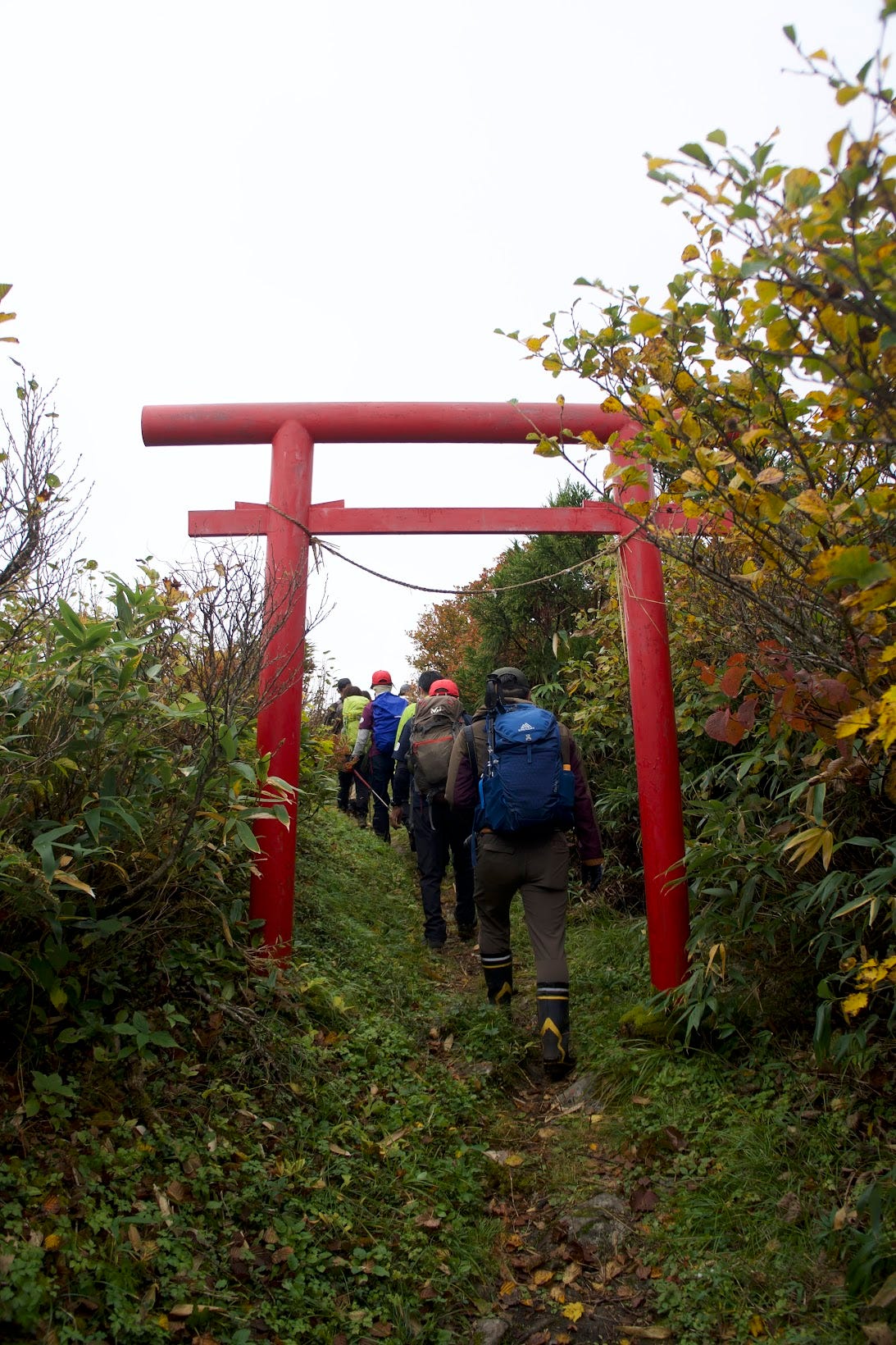
Then, there is a turnoff for the summit. The summit is a clearing that offers expansive views over the surrounding mountains and the villages and cities of inland Yamagata Prefecture. However, the real attraction of Murayama Ha-yama has got to be Hakuban Jinja, another 20 or so minutes away.
Hakuban Jinja
Reaching Hakuban Jinja gives you a real sense of achievement. Looking back, you can see just how far you’ve come. Plus, the surrounding cliff faces coupled with the autumn leaves are a real sight to behold. If you look towards the north-west, you can also make out the Shonai region, and The Sea of Japan. If the weather is favourable, you can see the behemoth that is Chokai-zan as well. This alone makes the 3 or so hours it takes to get there well worth it.
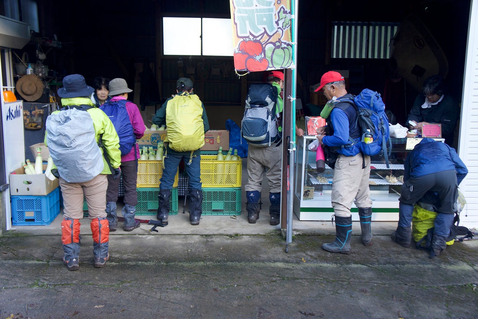
Then it’s just a matter of retracing your steps all the way back to Shimin-so. When you arrive, you'll see a small shop selling local produce, a small reward for a hike well done.
Hata Trail (3 hours one-way)
The Hata Trail starts at Ha-yama Shimin-so, a purpose-built mountain hut. The Chomei-sui ‘spring of longevity’ spring water lies here, and there is a farmer’s market right nearby. This trail includes many recommended spots such as the primeval forests, lookout over the Murayama region, and the Ostubo Rock with its amazing views. The trail takes you to the Oku-no-in (Hakuban Jinja) and over Kozo-mori, Ozo-mori, and Murayama Ha-yama’s summit.
The Iwano Trail from the Murayama City side, and Shamu Trail meet the Hata Trail at the field of flowers.
Yamano-uchi Trail (4 hours one-way)
Although Murayama Ha-yama’s longest and most demanding trail with a difficult rocky area in the area along the way, the Yamano-uchi trail is blessed with great views. The trailhead begins at the Otori gates at the end of the forest road, where you can park your car. After about one hour along the steep ridge that goes through the primeval beech forest, you will come across the beautiful Takimi-dai waterfall.
Following that, there is a rock called the Toriboshi-ishi (bird’s hat rock). This rock requires the use of a rope to get past. A little while after weaving your way past the steep slopes of Kogomuro-yama (uncertain reading, 古御室山), you will come across some marshlands. Then, keep following the path while keeping an eye on the Zazen-ishi (Zazen rock) to the left. Soon you will come to a junction leading to the summit and Oku-no-in. The view from the Oku-no-in is more open.
The road to the trailhead is unpaved and there are bumps along the way. However, normal cars should be able to get there fine.
Jubuichi-Toge Trail (90 minutes one-way) (Access road currently closed)
The Jubuichi Toge trail is considered the easiest of all trails up Murayama Ha-yama. The road among the forest up to the trailhead is narrow and made of dirt. Furthermore, there is only limited space for cars to park, so be aware of this when parking. For winter, Route 458 to the Jubuichi trailhead closes from mid-November to June the following year.
Hijiori Trail (2 hours 30 one-way)
The Hijiori Trail is more suited to intermediate and above hikers due to the constant incline from the start and the narrow and slippery-at-times trail. This does mean that the sense of accomplishment at the summit is something special, however. The Hijiori Trail offers a large variety of mountain vegetation, including, depending on the season, fresh mountain vegetables and mushrooms. At the trailhead, there is space for about five cars. The same as the Jubuichi-toge trail, the road to the trailhead, Route 458, closes from November to mid-June.
Nearby locations worth visiting
Gassan and Ubaga-take

Haguro-san and Yudono-san are on the opposite side of Gassan from where Murayama Ha-yama lies. However, Murayama Ha-yama has trailheads to Gassan. The other option would be to go to the Gassan Ski Lift in Nishikawa Town. Ubaga-take and Gassan can be accessed from there.
Dewaya Ryokan in Nishikawa
Famous for its unique take on Dewa Sanzan mountain vegetable cuisine, Dewaya Ryokan in Nishikawa is a must-stay Ryokan in Nishikawa Town.
Yukihira Coffee in Nakayama Town

Just south of central Sagae City, Yukihira Coffee is a tiny coffee stand in Nakayama Town. Offering both blends and single origin coffee, Yukihira Coffee is one of the best cafes in the prefecture. They also have a selection of sweets (try the Canelé!). Plus, a broad range of coffee-making paraphernalia that is sure to please any coffee-lover.
MURAYAMA HA-YAMA
村山葉山 | むらやま はやま
Hayama (Murayama), Ha-yama, Murayama Ha-yama, Mt. Hayama, Mt. Hayama (Murayama)
Murayama Ha-yama ((村山)葉山(むらやま)はやま) is a 1462m (4796 ft.) peak in the Shonai region of Yamagata prefecture best hiked from June to October. Murayama Ha-yama is a level 3 in terms of physical demand, which means it is moderate to hike, has an A technical grade, which means it requires little expertise, and you want to allow at least 3 hours for a climb.
Mountain Range
Gassan
Region
Murayama, Mogami
Elevation
1462m (4796 ft.)
Technical Demand
A (requires little expertise)
Physical Demand
3 (moderate hike)
Trails
Four. 1) Hata Trail (3 hours one-way) , 2) Yamano-uchi Trail (4 hours one-way), 3) Jubuichi-Toge Trail (90 minutes one-way) (Access road currently closed), 4) Hijiori Trail (2 hours 30 one-way)
Best time to climb
June to October
Day trip possible?
Yes
Minimum Time Required
3 hours
PDF Maps by TheHokkaidoCartographer and JapanWilds.org. See all here.
100 Famous Mountains of Tohoku, 100 Mountains of Yamagata, Autumn Leaves, Forest Bathing, Full Day Hikes, Half-day hikes, Hard to reach, Historical Hikes, Mogami Region, Mogami River, Mountain Flowers, Mountains above 1000m, Murayama City, Murayama Region, Okuramura Town, Sagae City, Shugendo Mountains, Volcanoes, Waterfalls, Wetlands, yamabushi


YAMABUSHI NEWSLETTER
KIWI YAMABUSHI

TIM BUNTING - KIWI YAMABUSHI