Wetland Wonderland of Takadate-yama
たかだてやま
高館山
TAKADATE-YAMA
Takadate-yama is short in stature, but packs a lot of punch as home to one of the only RAMSAR wetlands in Japan
In spite of its small 274m stature, Takadate-yama sure packs a lot of punch. First, the Shimo-ike and Kami-ike lakes are Wetlands of International Importance. This alone means Takadate-yama boasts a huge variety of migratory birds. However, the mountain also has forests among the top 100 in Japan for Shinrinyoku (forest bathing). Plus, the summit lookout shows 360° views over The Sea of Japan, Chokai-zan, The Shonai Plains, Gassan, Kinbo-zan and Arakura-yama.
Getting to Takadate-yama

Takadate-yama lies in Oyama, in the western part of Tsuruoka City. It's a little tricky to get there. I'd definitely recommend Google Maps. In short, Hotoria Nature Centre is where you want to go. From Tsuruoka Station, head north on Route 332, until you get to Route 50 where you take a left. Keep following this road and go straight at the traffic lights. Take a left, and then the second right. Follow this road and you will see Takadate-yama and Hotoria Nature Centre.
Climbing Takadate-yama

Climbing Takadate-yama turned out to be quite the adventure. To be honest, at first I wasn’t as excited as I would be for taller mountains. I thought Takadate-yama would just be a simple short climb through the forest to the top. Then I could just climb back down along a different but similar route. I could not have been more wrong.
Hotoria Nature Centre and the Ramsar Site

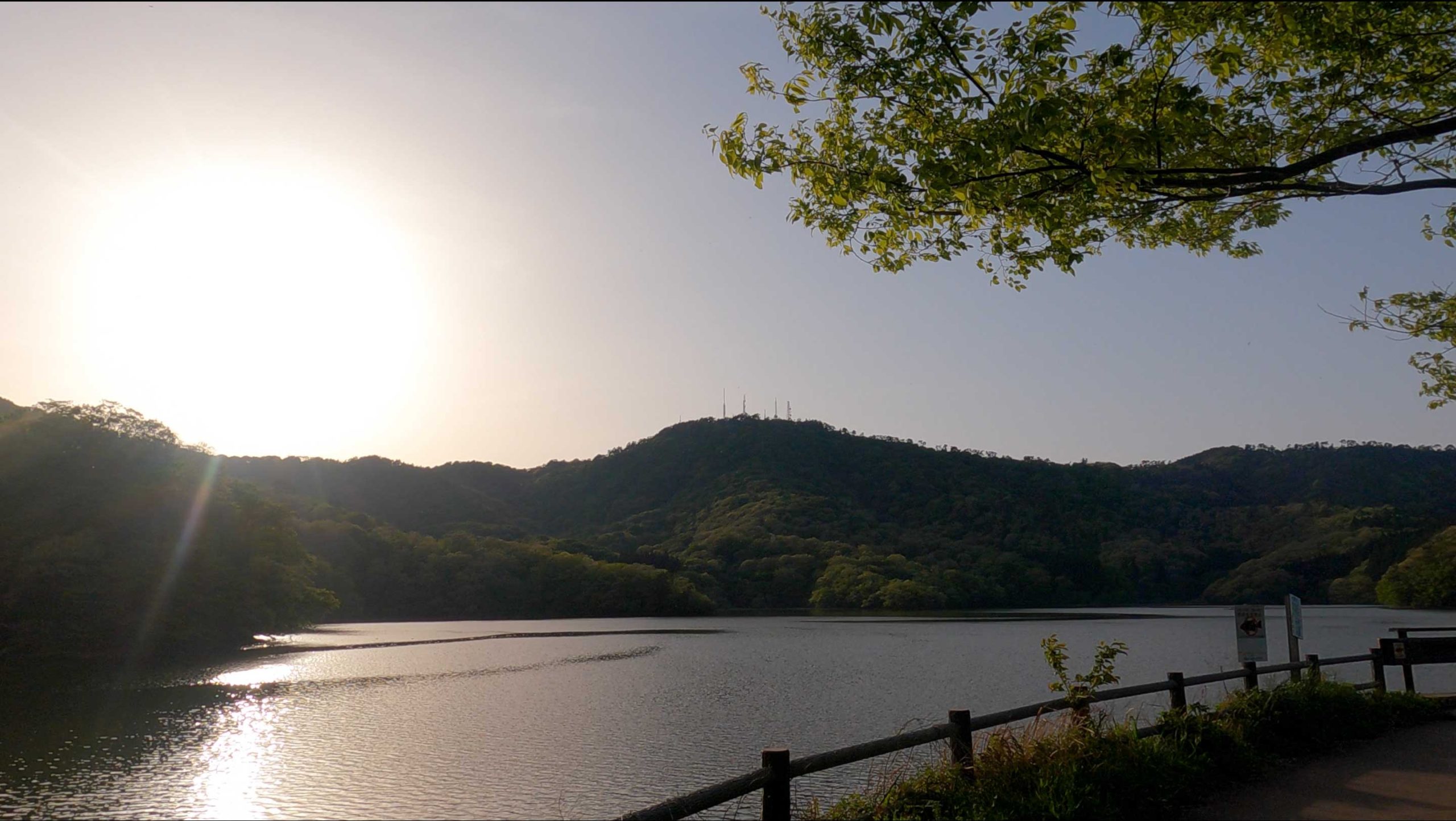
Adjacent the Shimoike lake at the base of Takadate-yama is the Hotoria nature centre. This for the Tsuruoka City Nature Study group and make the perfect location to park your car. Here you can read up on the local flora and fauna before heading out into the mountains. Hotoria was set up in 2008 when The Shimoike and Kami'ike lakes became a Ramsar site. These lakes are one of over 2,000 Wetlands of International Importance worldwide. These lakes were formed more than 400 years ago to provide fresh water for agriculture in the surrounding regions.
Flowers to be found on Takadate-yama
In Spring, the Asian fawnlily and the Yukinosei Japanese windflower are in bloom. In early summer, you may be able to spot the narcissus or the blue-and-white flycatcher birds. This part of Tsuruoka is also famous for the more than 20,000 Mallard ducks, Tundra swans, and other migratory birds that visit here from Siberia in mid-autumn. After getting their fix from the surrounding rice fields at dusk, the birds roost in both of the lakes. The Kami'ike lake is also especially famous for its lotus flowers during Obon each year.
I set out to hike Takadate-yama with my very good friend and fellow Yamabushi Tak. From Hotoria, the path isn't very hard to find. Head in an anti-clockwise direction around the Shimoike lake. You'll soon see the trailhead at the edge of a forest (and bear sign). The first part of the hike takes you through a forest trail weaving around the outer rim of the lake. Off this path are the Kanezawa and Osawa trails leading up to the summit. We opted for the Iwakura trail as recommended on the Yamagatayama website (Japanese).
Get your Forest Fix: Shinrinyoku on Takadate-yama

The next part of the trail is probably where Takadate-yama got its Shinrinyoku reputation. Apparently, the felling of trees was banned on Takadate-yama from the 17th to 19th centuries. This was when the mountain was under direct control of the Edo Government. For us, this means a surprisingly large number of old broadleaf trees such as Beech and Zelkova remain.
We took the Iwakura trail up through this forest. This trail is part of the Shin-Okunohoso-Michi. This path, 'the New Narrow Road to the Deep North' was inspired by Matsuo Basho's premiere collection of Haiku. The forest was almost completely overgrown in parts with only a small path visible. Also, we occasionally had to walk on slippery mud or the classic wooden bridges just to get past. As expected, there were a lot of gnarly looking Zelkova and Beech trees in the dense bush along the way. Needless to say, Takadate-yama is well worth its reputation!
The Summit of Takadate-yama

Follow the Iwakura trail and you will eventually come out at the road that leads to the top. Besides the lookout, the summit of Takadate-yama itself isn’t exactly exciting. There are about 5 or 6 cell towers, and a small open area with a pagoda. In this small open area you'll see the tall tower with lookout at the top. The day we went visibility was probably the best it could be. There are unbeatable views of the Sea of Japan, Chokai, the Shonai Plains, Gassan, Arakura-yama, Kinbo-zan. We could even see Tobishima Island, home to Kashiwagi-yama.
Heading to Hachimori-yama

We took the same path back down the from the summit. However, we carried on down the road and came across the path to Hachimori-yama (234m). This path is similar to the Iwakura trail, although there are even more beech trees. This made it very similar to the path up to the top of nearby Arakura-yama. Once we reached the summit, Tak told me that when the trees are bare on Hachimori-yama you can see Gassan. Naturally, we decided to dedicate our Yamabushi prayers there.
I can see why Sendatsu always says it’s the prayers that make the difference when you’re out in nature; right in the middle of the forest, birds calling in all directions, branches swaying in the wind, and our voices calling out in unison, it was really quite humbling. Only those who have done Yamabushi can understand the feeling, but it was quite emotional. I would urge anyone to come join us on the mountains.
Hachimori-yama to Shimo'ike lake
From Hachimori-yama, we headed down to the opposite side of Shimo-ike lake. Through the trees, we could catch glimpses of Gassan. Eventually we came out of the forest, and what a sight to behold. We arrived at Oyama park with views of not only Gassan, but also Tsuruoka City, Kinbo-zan, and the Kami'ike lake. This park is apparently famous for Sakura, so I will have to visit again next year. Cut across Oyama park and if you're lucky, you can see Chokai in the distance. From here, the path back along the Shimoike lake to Hotoria is self-explanatory.
Trails up Takadate-yama

Altogether, taking the Iwakura trail to the summit then returning via Hachimori-yama took us about 3 hours. Overall, this path was shorter than Kinbo-zan from Shoryuji Temple, and shorter than Arakura-yama. However it is similar to Kinbo-zan from the Yutagawa entrance. This makes it great for an afternoon or a morning hike. If you wanted to, you could make a day of it by bringing a picnic. Takadate-yama truly lived up to its reputation as one of the top 100 spots for Shinrinyoku. The wildlife was really cool too, although I didn't see too much. Now I'm going to have to come back to take in the autumn leaves. Here's hoping we can get views of Gassan at the time.
Places to Explore Nearby

Mountains of Sakura: Arakura-yama
The mountain directly south of Takadate-yama is Arakura-yama. As I wrote about in the article, Arakura-yama is famous for the mountain Sakura trees, but also for the breathtaking Arakura Jinja Shrine, which is easily reachable by car from the car park of Takadate-yama. If you're up for it, it's possible to do Arakura-yama and Takadate-yama on the same day. The best way to do this is to bring a friend, park one car at Hotoria at the base of Takadate-yama, then drive another car to Yura. Hike Arakura-yama from Yura, then head towards Takadate-yama, and come back down to your car in Hotoria. Then all you need to do is pick up the other car.
Oyama, Tsuruoka City
Oyama town to the west of Tsuruoka City is famous for its Dog festival in May, Sake festival in February, Honcho Tsukemono, Fukunoya bakery, and Zenpoji Temple.
The Monastery at Zenpoji Temple

There is a famous Zen Temple Monastery called Zenpoji Temple in Oyama, Tsuruoka is the only temple in Japan dedicated entirely to the ocean. Legend has it that 1100 years ago, the founder of the temple, Myotatsu Shonin was reading Mantras when two people came to hear these lessons from Buddha. When Myotatsu Shonin questioned their identity, they showed their true form: the two were actually dragon gods. After that, the two gods flew off to the lake behind the temple. As dragons control the water in the east, Zenpoji Temple came to be known as a protector of the ocean. Since then, Zenpoji Temple has been training ground for monks of the Soto sect of Buddhism.
The Temple Buildings of Zenpoji Temple
The buildings at the base of Zenpoji Temple in Tsuruoka were funded through donations by fishers and merchants from the surrounding area. In fact, the Shonai area, and Sakata City to the north in particular, is known as the home to the once richest family in Japan. The Honma family of Sakata made millions through trade of rice and safflower on the Kitamaebune ships that traded all throughout Honshu and in parts of Kyushu. They left behind these masterfully-built structures that last as they were built all those years ago that we can enjoy to this day.
Zenpoji Temple is also home to a very special piece of Dewa Sanzan history. Inside the temple in one of the halls, you will find 13 statues of Buddha that were originally housed at the top of Gassan. They were brought to their current location during the Meiji Restoration (1868 onwards) for safe-keeping away from the widespread destruction of Buddhist Artifacts enacted by the government. It is unsure as to whether they will be returned to their original location as Gassan now falls under the administration of Dewa Sanzan shrine. However, the recent construction of Senbutsudo, a special hall built on Haguro-san for other Buddhist artefacts hidden over the years is a sign that anything is possible.
TAKADATE-YAMA
高館山 | たかだてやま
Mt. Takadate, Takadateyama, Mount Takadateyama
Takadate-yama (Mt. Takadate, 高館山たかだてやま) is a 273m (895. ft.) peak in the Shonai region of Yamagata prefecture. Takadate-yama is best climbed when there is no snow (usually March to November). Takadate-yama is a level 2 in terms of physical demand, which means it is relatively easy to hike, has a A technical grade, which means it requires little expertise, and you want to allow at least 1 hour for a climb.
Mountain Range
Maya-san
Region
Shonai
Elevation
273 m (896 ft.)
Technical Demand
A (requires little expertise)
Physical Demand
2 (a little tough)
Trails
Many, recommended: Iwakura Trailhead or just looping around the Shimo'ike lake
Best time to climb
Once the snow melts (March to November)
Day trip possible?
Yes
Minimum Time Required
One hour for a walk around Shimo'ike, longer if hiking up the mountain
PDF Maps by TheHokkaidoCartographer and JapanWilds.org. See all here.


YAMABUSHI NEWSLETTER
KIWI YAMABUSHI

TIM BUNTING - KIWI YAMABUSHI