Mythical Beasts, Buddha’s Mother, and buried Yamabushi treasure? Welcome to Maya-san (Mt. Maya).
まやさん
摩耶山
MT. MAYA
More than one of the best hikes in Shonai
Maya-san has intrigued me ever since my yamabushi friend first told me about it being one of his favourite hikes in all of Japan. From someone who is a fellow yamabushi mountain dweller, but also a professional mountain guide with experience on mountains all over Japan, this is really saying something.
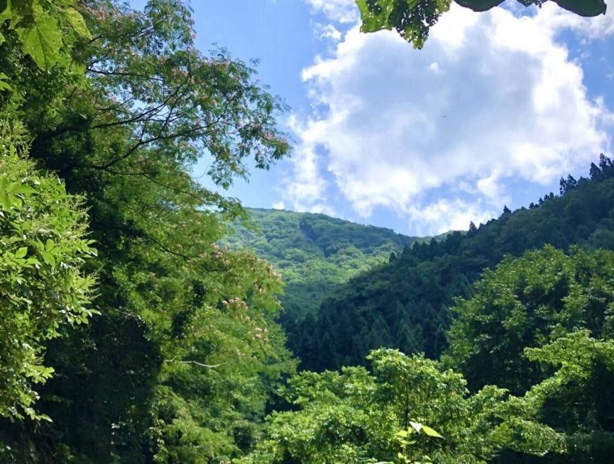
However, that friend was just talking about the hike. The primeval beech forests, rocky cliffs, waterfalls, and mountain streams of Maya-san helped it become one of the 300 Famous Mountains of Japan, but for me the backstory of this Shugendo peak to the south of Tsuruoka City is where it’s at.
Maya-san’s Namesake: The Mythical Ryuma Dragon-Horse

Maya-san’s name is something of a legend, quite literally. Originally, Maya-san was known as ‘stable mountain’ 厩山. So, why a stable? Well, If you’ve ever come across any ancient Japanese myths, most likely you would have heard of Susano’o, the son of Izanagi and Izanami, the original creators of the Japanese archipelago, and brother to Amaterasu, the Goddess of the Sun. Legend has it that Susano’o rode to the top of Maya-san on a Ryuma, a mythical beast that is a cross between a horse and a dragon.

Maya-san marked the border between the ancient provinces of Echigo in the current day Niigata Prefecture, and Dewa Province in the current day Yamagata Prefecture. This Ryuma was believed to be the guardian god of the Tsukisaranoki Palisades that ran across the border. It is then only logical that they should be kept in a stable, Umaya in Japanese, from which the name Maya originated.
Buddha’s Mother and Shugen Yamabushi Training on Maya-san
Then, in the early stages of the Heian Period (794–1185), the surrounding area was heavily influenced by Shingon Buddhism, with Maya-sandesignated as a sacred ground. During this time the Kanji characters of the mountain changed to reflect more of a Buddhist nature to its current 摩耶, Maya, after Queen Maya of Sakya, the birth mother of Gautama Buddha.
It’s not uncommon to see a connection to Japan’s unique belief system of Shugendo in the mountains in the Shonai region; Haguro-san, Gassan, and Yudono-san, the three Dewa Sanzan especially, but also in other nearby mountains such as Arakura-yama and Atsumi-dake. As the highest peak in the Kinbo Shugen line of Shugendo, Maya-san is definitely no exception.
Meeting Maya Gongen and the Shugendo of Maya-san

Home to Maya Gongen (avatar), Maya-san entered a prosperous time as a popular destination for followers of Sangake Shugen mountain worship. These followers were of the Kinbo Shugen sect based on Kinbo-zan, a peak at the foothills of Maya-san.
From the late Edo period (1603–1868), however, Maya-san was seen as a strategic location for defending the Shonai Domain from the Imperial Army. This meant that all mountain worship on Maya-san ceased, leading to a sharp decline in Kinbo Shugen that never really recovered, although some do still practice Shugendo on Mt Kinbo (this yamabushi included).
Yamabushi Treasure Buried on Maya-san

At some time in the past, senior Yamabushi from Haguro-san are believed to have escaped to Maya-san from a feud on the Dewa Sanzan’s lowest peak. It is believed that these yamabushi brought with them vast treasure that they then buried in Maya-san. The reason for this belief? A song sung by the yamabushi that went, “sparkling at dawn, brilliant at dusk, there under the crumbling rock”. So, who knows? You may just come across some ancient buried treasure on Maya-san!
Hiking Maya-san: The Three Trails

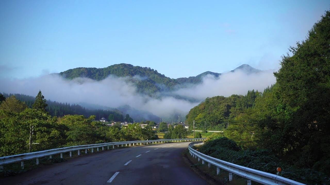
Located on the border of Niigata and Yamagata Prefectures, Maya-san has a ridge that forms the border between Asahi village (not to be confused with the nearby Asahi Town) to the east, and Atsumi to the west, both in Tsuruoka City.
Both sides of Maya-san have trails, although the eastern side is markedly steeper, definitely more for experienced hikers. The Arasawa Trailhead lies to the east starting in Asahi village, and the Koesawa and Sekigawa Trails start in Atsumi to the west. The trails are relatively similar in terms of distance, and you want to allow at least 3 hours one way to be safe.

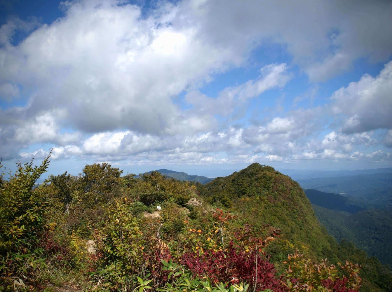
Maya-san is especially beautiful when the autumn leaves are out, usually around mid-October to late November, but can be climbed from around June. Formed primarily of granite with steep inclines known widely throughout the prefecture, the summit of Maya-san is 1,019m above sea level.
The Arasawa Trail from Asahi Village to the east

Maya-san’s Arasawa Trailhead is located deep in the mountains of Asahi village to Tsuruoka’s south. While the western face is home to a primeval beech forest, the Arasawa trail is known for its exposed ridges that are particularly steep, and the alpine grasses that stick to the cliff face, the only thing that can really get a hold.
The distance from the Arasawa Trailhead to the summit of Maya-san isn’t that far, though it is steep. Although the steep path means the climb is tough, it also means you are quickly rewarded with great views. Just make sure to check that the chains and ladders have been installed before taking this route. They are usually up by early June, and taken down at the end of November, however this could change due to the conditions.
Hiking Maya-san from the Arasawa Trailhead

Starting from the Arasawa Trailhead, the path takes you up to a steep incline, with the real climb beginning from the Mizuki (水月) split. The path that veers off to the right is called the Sorikura path, which has bad footing as well as snow at times, so this is generally for experienced climbers only. The path to the left is called the Nakamichi path and has chains and ladders, so is also a difficult climb. Most opt for the Nakamichi path as this is considered the safer option.
There is a bus to the entrance of the Arasawa Trailhead from Tsuruoka Station, although you’ll still have to walk 4.5km to get the the actual trailhead. To be honest, with the infrequent busses, I’d highly recommend taking your own transport to make things considerably easier.
Getting to the Koesawa Trail on Maya-san

The Koesawa Trail is one of the two trails that starts in the former Atsumi Town part of Tsuruoka City on the western side of Maya-san, the other being the Sekigawa trail. The Koesawa Trailhead is easy to spot if driving south on the 345 from central Tsuruoka. You will see a turnoff the left that has the sign there, and also a small hut that is pretty hard to miss.
At the end of a narrow path that goes up the mountains you will find a carpark where the trail begins proper. The view when I was there was spectacular, so I had to get out and get some photos, but that day I was planning on climbing from the Sekigawa Trailhead.
Hiking Maya-san from the Koesawa Trailhead

Following along a mountain stream, the Koesawa trail starts out easy, but gets harder as you get further up the mountain. After climbing a ladder to the side of the Benzaiten Falls, there is a crossroads. A right-hand turn will take you to the Sekigawa trail past the Nanatsutaki Falls. Keep following the path straight, however, and you will eventually reach the summit.
There is a bus to the entrance to the Koesawa trailhead from Atsumi station, however you have to walk 3km to get to the actual trailhead, and again I’d recommend personal transport.
Getting to the Sekigawa Trailhead on Maya-san

The Sekigawa Trail is the second trail from the former Atsumi Town of Tsuruoka City on the western side of Maya-san, but you have to be careful because the entrance can be a bit hard to spot. Heading south on Route 345 from central Tsuruoka, the entrance is over a little bridge to the left, just north of Sekigawa and a little bit after the Koesawa Trailhead. But be careful, I missed the turnoff for this trailhead and unnecessarily went all the way to the Sekigawa township.
It’s not far, but if you find yourself there where the road gets very narrow, and you see the Sekigawa community centre, you’ve gone too far. Head back up the 345 until you find the right entrance.
Then, all you need to do is to follow the narrow gravel road up through the cedar forest, and eventually you’ll find yourself at a small power transformer where you can park your car and begin the hike.
Hiking Maya-san from the Sekigawa Trailhead

In contrast to the river of the Koesawa Trail, the Sekigawa Trail takes you along a ridgeline through the primeval beech forest, which is quite remarkable in itself, for a long while. After climbing for about an hour, there will be a red sign that reads ‘wildlife protection area’.
Just before this there is a path that will take you to the Koesawa Trail. It is perfectly fine to continue straight up the path, which will take you to a water source, and then Maya-san’s emergency hut.
The Nanatsuki Falls on Maya-san
If you can, however, I would suggest backtracking a little on the path that cuts back to the Koesawa Trail, but then take the first right and you will be led to the Nanatsutaki Falls. The Nanatsutaki Falls has a ladder beside it to climb up, and once you’re at the top you will find the emergency hut and will be back on the Sekigawa Trail.
If you climb up this way, you can take in the Nanatsutaki Falls, and won’t have to climb down the ladder on the way back if you opt for the normal Sekigawa Trail. If like me you forget about the Nanatsutaki Falls but still want to see it when you reach the emergency hut, take a left past the emergency hut, and backtrack a little bit. The Nanatsutaki Falls isn’t that far.
From the Emergency Hut to The Summit of Maya-san

From the emergency hut, the only way to go is up. After a steep incline requiring climbing a few ropes, meeting a few Jizo statues and seeing the Oku-no-Miya, Maya-san’s small inner shrine, eventually you will find yourself at the summit.
Just in case, there is a water source located a little down the Sekigawa trail from this emergency hut. Once again, there is a bus from Atsumi Station that goes to the entrance to the Sekigawa trailhead, but again, you would have to walk the 3km to the actual trailhead, and I’d definitely recommend your own transport.
The Summit of Maya-san

If you’re there on a good day, Maya-san has some amazing 360° views over Sado Island in Niigata Prefecture, the Asahi Mountain Range, Gassan, Chokai-zan, the Shonai plains, Tobishima Island, The Oga Peninsula in Akita Prefecture and of course The Sea of Japan. There are also quite a few mountains nearby that poke up in the background, and if you’re there in autumn, it makes for some very amazing views indeed!
In conclusion: Maya-san

I know I recently said this about Kyogakura-san, but Maya-san is also quickly becoming one of my favourite peaks. Like Kyogakura-san, not only does Maya-san have great options for hiking trails, but is also has an amazing backstory, two things that I have really enjoyed learning about during my 100 Famous Mountains of Yamagata project.
Nearby Locations Worth Checking Out
The Yamabushi trails of Kinbo-zan
Maya-san was the peak that followers of Kinbo Shugen based in Kinbo-zan aimed for, as it is the highest mountain along that whole ridge. Between Kinbo-zan and Maya-san there are a number of peaks: Yoroga-mine, Hokari-yama, Yunosawa-dake, and then Maya-san.
It should be possible to climb from Kinbo-zan to Maya-san, however I believe it would take a very long time, and you may be forced to stay on the mountain somewhere. It’s best to do these mountains separately, or to do a ‘traverse’ which was recommended to me by someone who had a say in which mountains were to become the 100 Famous Mountains of Yamagata. To do this, take two cars and go from Yunosawa-dake from the eastern side, and climb down to Kinbo-zan.
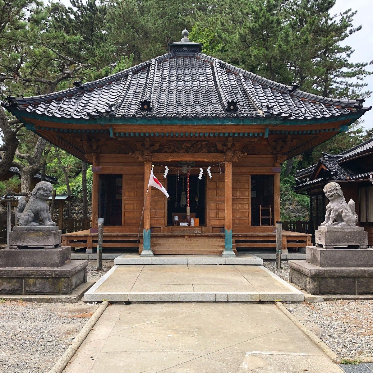
Yakushi Shrine and The Battle of Sekigawa

Sekigawa is a tiny town with a huge history. On the 11th of September 1868, the Imperial Japanese Army had set their sights on attacking Sekigawa. At the time, the Shonai Domain was the only supporter of the Tokugawa Shogunate, and they were surrounded 360°, but the Shonai Domain climbed the hills by Sekigawa and mounted a surprise attack. At the end of a tough battle, the Shonai Domain fell back.
The Shonai Domain tried valiantly to counter the Imperial Army’s forces from Sekigawa but weren’t able to get very far, and on the 27th of that same month, they surrendered. Up until then the Shonai Domain were unstoppable, and Sekigawa was the only place to lose any ground during the war.
As one of the most important locations during the 1868 Boshin War when Shonai was under siege from the Imperial Japanese Army. The Shonai Domain was the last area to hold out against the Imperial Army, having support with modern weapons from Prussia at the time, yet they were surrounded 360° and had to surrender in an effort that led to the abolishment of the Samurai class. From this fight the Shonai Domain lost 53 soldiers.
Shinaori Weaving: The Lifeblood of Sekigawa

Located on the borders of Niigata and Yamagata Prefectures deep in snow country, Sekigawa is famous for its Shinaori weaving. With Shinaori, fibres of the linden tree (Shina) are woven into all sorts of daily goods such as baskets, umbrellas, hats, and bags. During the winter months when it was impossible to get anywhere, Sekigawa locals got together to weave these amazing works of art. In fact, Shinaori was so important to the local economy that it was said the number of weavers determined the population.
At the Nukumorikan in Sekigawa, you can try your hand at weaving with classes for making coasters or more elaborate designs. See more here (website translated by yours truly).
Conquering Japan on Nihon-koku
It’s only a 15 minute drive from Sekigawa to another mountain on the 100 Famous Mountains of Yamagata list, Nihon-koku. Nihon-koku literally means ‘The Country of Japan’, so if you hike to its summit, you can truthfully say ‘I conquered Japan’.
Atsumi Onsen and Atsumi-dake
If you’re looking for somewhere to relax after a long hike on Maya-san, nearby Atsumi Onsen will be your best bet. Atsumi Onsen is one of Tsuruoka City’s three Onsen towns (the other two being Yutagawa, and Yunohama), and is the coolest places in the Shonai region. Located at the southern end of Tsuruoka, with only Nezugaseki further south, Atsumi Onsen is a great spot for a walk amongst the Sakura in spring, or a visit to the rose garden in June. While you’re there though, if you’re not staying at Tachibanaya with their awesome onsen, do be sure to check out Chitto Mocche, a locally-run cafe that is famous for its outdoor foot baths.
For nearby mountains, and ones that are definitely worth the effort, Atsumi-dake is one of the 100 Famous Mountains of Yamagata located in Atsumi Onsen. Atsumi-dake is famous for its long mountain stream and as a former Shugendo mountain complete with Kumano Shrine and decommissioned Shukubo pilgrim lodge.
The Fishing Village of Nezugaseki
Nezugaseki is the town at the southernmost point of Tsuruoka City’s Shonai coast, and was once one of the main checkpoints into the Ou region (the other two were in Shirakawa and Nakosonoseki). According to local legend, Nezugaseki was the checkpoint where the events of the famous Kabuki play Kanjincho took place.
The tiny fishing village of Nezugaseki has a few peculiarities worth checking out, such as Itsukushima Shrine, the Nenjunomatsu Garden, and Asahiya Sushi Restaurant. Itsukushima Shrine isn’t that grand, but it has many cool statues and artefacts and juts out on the coast where there is a pretty cool lighthouse to explore.
MT. MAYA
摩耶山 | まやさん
Mt. Maya, Mt. Maya-san, Mayasan
Maya-san (Mt. Maya, 摩耶山まやさん) is a 1019m (3343 ft.) peak in the Shonai region of Yamagata prefecture. Mt. Maya is open from June to October. Mt. Maya is a level 2 in terms of physical demand, which means it is relatively easy to hike, has a C technical grade, which means it requires a moderate level of expertise, and you want to allow at least 5 hours for a climb.
Mountain Range
Asahi
Region
Shonai
Elevation
1019m (3343 ft.)
Technical Demand
C (requires some expertise)
Physical Demand
2 (relatively easy to hike)
Trails
1) Arasawa Trail (6 hours return) 2) Koesawa Trail (6 hours return) 3) Sekigawa Trail (5 hours return)
Best time to climb
June to October
Day trip possible?
Yes
Minimum Time Required
5 hours
PDF Maps by TheHokkaidoCartographer and JapanWilds.org. See all here.
100 Famous Mountains of Tohoku, 100 Mountains of Yamagata, Ancient paths and trails, Autumn Leaves, Buddhist Temples and Shinto Shrines, Forest Bathing, Full Day Hikes, Hard to reach, Historical Hikes, Kinbo Shugen Mountains, Mountains above 1000m, Myths and Legends, Shonai Region, Shugendo Mountains, Tsuruoka City, Waterfalls


YAMABUSHI NEWSLETTER
KIWI YAMABUSHI

TIM BUNTING - KIWI YAMABUSHI