Hiking Japan’s Forgotten Highway: Sabane-yama and Ushu-Kaido (Mt. Sabane)
さばねやま

猿羽根山
SABANE-YAMA
The odd connection between Osaka castle, the Shinkansen and Shinjuku, and the mountains of Yamagata.
Skip to My Guide to Hiking Sabane-yama
There’s a certain romance about purposely taking the slow route; reading the book rather than watching the movie, taking the train rather than flying, walking instead of driving the car. Not only do you get an entirely different perspective, that perspective gives you insights that never would have been possible had you taken the easier route. And nowhere could this be truer than in Japan.
In all honesty, I wasn’t too surprised to find out Japan is covered in highways. And I don’t mean those modern monstrosities that epitomise the word concrete. I mean Japan’s forgotten highways; highways of a time long gone, when all people had to get around on was their own two feet, when they were all but forced to take the slow route.
Ok, sure, Japan is an ancient country. It’s not too much of a stretch for an ancient country to have ancient highways. But the way these highways came about is truly something. And it involves an odd connection to Osaka, Shinjuku and the Shinkansen, and the mountains of Yamagata.
It all Started with Osaka Castle
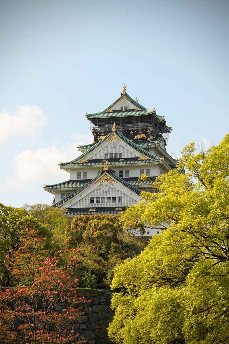
Way back in the 16th century, samurai and Daimyo (feudal lord) Toyotomi Hideyoshi, one of the great unifiers of Japan, made a law where the wives and heirs of his Daimyo were forced to reside in or around Osaka Castle. His motivation for keeping hostages in this way was simple: maintain his Daimyo’s loyalty.
And it worked.
It worked so well, in fact, the custom passed on to the Shogun in the following centuries, right up to the collapse of the Tokugawa Shogunate in 1868.
Medieval Micromanaging

If you think your boss is a micromanager, try this on for size. During the Edo period (1603–1868), alongside the hostage situation, the Shogunate established the Sankin Kotai system of governance. In the Sankin Kotai system, Daimyo had to spend alternating years in their own fiefs, and in the de facto capital at the time, Edo, the city we know these days as Tokyo.
To make matters worse, the Shogun took a leaf straight out of Toyotomi Hideyoshi’s book. Yet, rather than keeping the wives and heirs in Osaka Castle, they opted to keep them in Edo instead. As if the Daimyo hadn’t already faced their fair share of the Shogun’s wrath.
All Heirs
On the surface, only getting to see your loved ones a year at a time sounds like the stuff of nightmares. But don’t worry, it wasn’t that bad. Before long, the Shogun established a series of routes linking Edo with the Daimyo’s fiefs called Gokaido, The Edo Five Routes. Put simply, these routes made it much easier for the Daimyo to not only communicate with the capital, but also importantly to be with their beloved Shogu… wives. Their beloved wives.
The Edo Five Routes
In a process that linked multiple 1,000-year-old trails to Nihonbashi, central Edo, five routes were selected to become the official Edo Five Routes; Tokaido, Nakasendo, Koshu Kaido, Nikko Kaido, and Oshu Kaido.
This is where the Shogun took micromanaging to a whole other level, but in a good way. Strict rules dictated not only the width of the roads, but where to place trees to keep those walking the routes cool as well.
In addition, post towns called Shukuba situated between 7 and 10km apart provided accommodation and meals along the routes, and there were even regulations for the number of horses permanently stationed at each.
Rules and regulations on The Edo Five Routes

Anyone could make use of the routes, however, only certain people were able to pass through the multiple sekisho checkpoints. Those able to pass through included the Daimyo of course, some merchants and craftsmen, and the servants to the Daimyo, AKA samurai.
Another notable exception was those on spiritual journeys. If you were making a pilgrimage to one of the sacred areas of Japan, for example the Kumano Kodo, Dewa Sanzan, or even places like Fuji-san, then you too were able to pass through. Pilgrims wore white Gyoi jackets that acted as a passport of sorts, and were therefore highly valued. These Gyoi jackets became the basis for Goshuin stamp books found in temples and shrines around Japan.
How the Tokaido Shinkansen got its Name
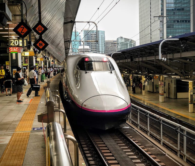
Avid train fans and non-fans alike may recognise the word Tokaido, as yes, this route is the namesake for Japan’s first bullet train, The Tokaido Shinkansen.
Two of The Edo Five Routes linked Edo and Kyoto; Tokaido, and Nakasendo. Tokaido means east sea route, as this route went along the pacific coast, south of Fuji-san.
The Nakasendo, ‘central mountain route’, on the other hand, went through the mountains of Honshu to the northwest of Edo and all the way to Kyoto.
How Shinjuku got its Name
The Shinkansen connection doesn’t stop there. The Koshu Kaido leading to Kai Province in present-day Yamanashi Prefecture played a pivotal role in both the establishment of Shinjuku City, and the world’s busiest railway station, Shinjuku Station. One of the Koshu Kaido’s first Shukuba post towns was the ‘newly built (Shin) post town (juku)’ of Shinjuku. (Incidentally, Harajuku was named after the Kamakura-do, part of the unofficial Edo Five Routes)
The Nikko Kaido
The Nikko Kaido connected Edo with Nikko Toshogu in present-day Tochigi Prefecture, a shrine dedicated to Tokugawa Ieyasu, founder of the Tokugawa Shogunate. Along this route, in memory of Tokugawa Ieyasu, one samurai lord, Matsudaira Masatsuna, took the task of planting trees to heart. In the process, he ended up planting the longest tree-lined avenue in the world, the cedar avenue of Nikko.
The Oshu Kaido
Lastly, I touched on it when introducing the pyramids of Japan, but the route north of Edo connecting to Mutsu, current-day Fukushima Prefecture, was known as the Oshu Kaido.
Besides the Sendaido that led to, you guessed it, Sendai, the Oshu Kaido had two subroutes; the Ushu Kaido that went through Yamagata and Akita Prefectures, and the Matsumae Kaido that went through Miyagi and Iwate Prefectures.
Both routes led to modern-day Aomori Prefecture, with the Matsumae Kaido going all the way up to Hakodate, Hokkaido. This made the Oshu Kaido the longest of the Edo Five Routes.
Roads and Rails: Hiking the Forgotten Highways of Japan
These days, it seems the majority of the Edo Five Routes are covered in either roads or rails. Although there are still walkable sections of the Nakasendo in its original form, I wondered whether there were any intact trails closer to home.
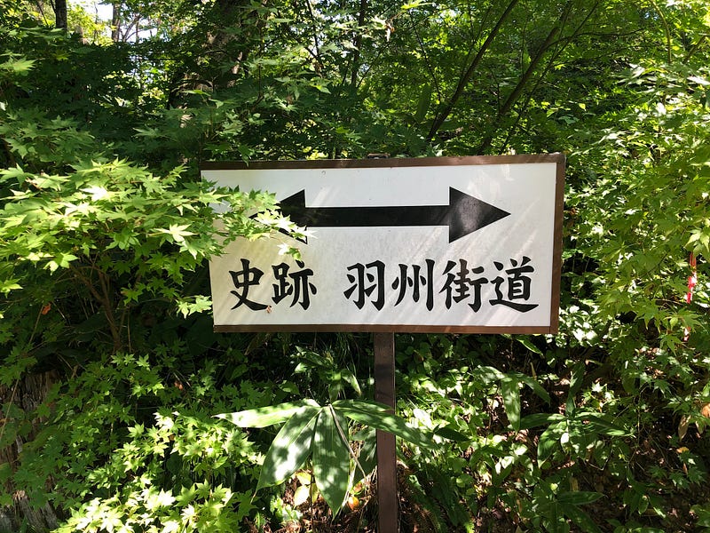
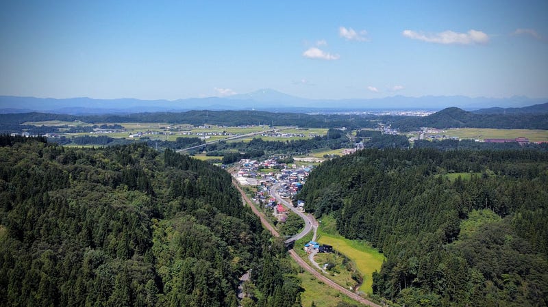
It turns out the prefecture I live in, Yamagata, had two main roads that were part of the Ushu Kaido; Route 7 and Route 13. Although these are now both roads, there was one section maintaining the former trail as is.
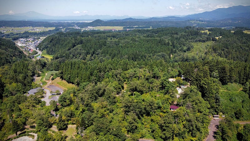
Route 13 is home to a mountain that was historically one of the most difficult passes of the Ushu Kaido, Sabane-yama. Not only that, Sabane-yama also happened to be one of the 100 Famous Mountains of Yamagata.
So, I decided to hike it, as a good yamabushi should.
The Forgotten Highway of Japan: Sabane-yama
Sabane-yama is not exactly what we would call a tough mountain to climb. In fact, since it is only 160 m (525 ft.) above sea level, we wouldn’t even call it a mountain in English (300 m or 1,000 ft. is the cut-off).
For us, it only takes a matter of seconds to get through Sabane-yama thanks to the invention of cars and the Funagata and Sabaneyama Tunnels.
Yet for the likes of Haiku poet Matsuo Basho, author Isabella Bird, local samurai Kiyokawa Hachiro, and countless Daimyo, Sabane-yama was one of the toughest parts of the journey between Edo and the northern Tohoku region.
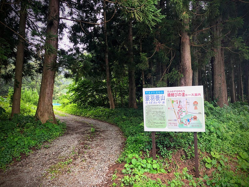
Hiking Sabane-yama
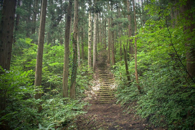
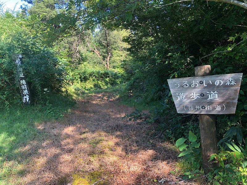
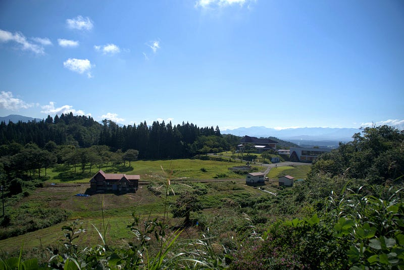
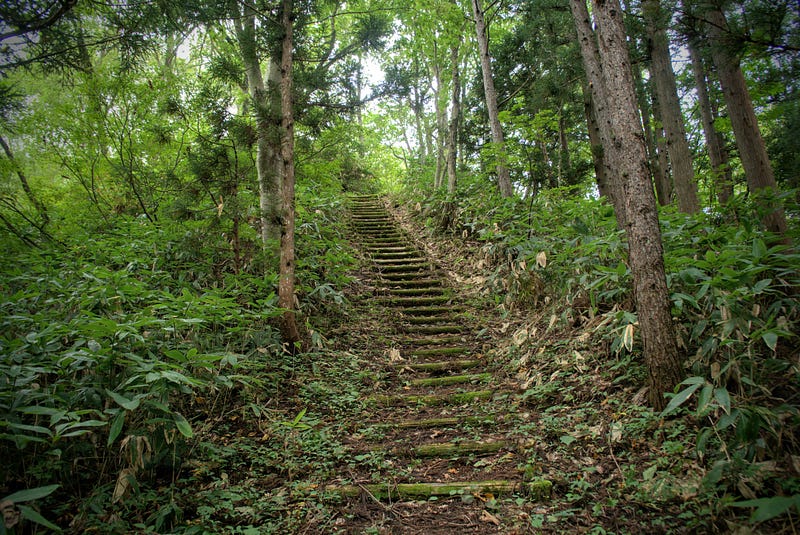
Starting off at Funagata Station, head south through the residential area. Soon you'll find yourself in a magical cedar forest. This forest guides you all the way up to the top of a ridge.
Keep following the trail through the forest. Eventually you will be led to the Nogyo Taiken Jishu Kan (a facility of agriculture studies). Be sure to take in the remarkable views of the surrounding mountains and valleys on the way.
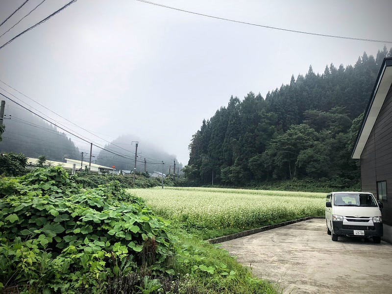
From here, it’s only a short hike to the Rekishi Minzoku Shiryokan (historical folk museum). Nearby, there are some soba restaurants and botanical gardens to check out.
Sabane-yama is part of the Sabane-yama Shizen Koen (Nature Park). As such, the area is well-maintained. There is also a large variety of flora you can stroll among during the warmer months.
Leave with an empty mind, and a full stomach
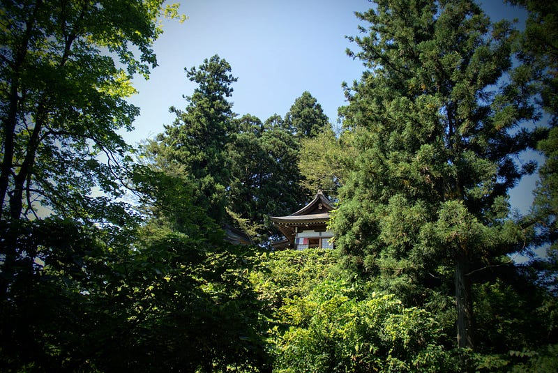
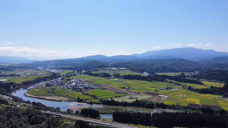
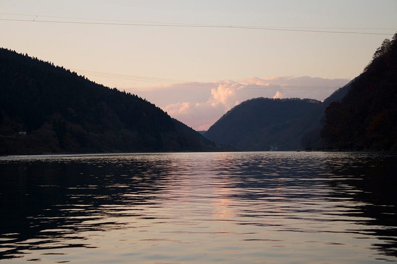
The main highlight of the area, however, has got to be the Zen Temple Jizo-do. This place alone is worth visiting. Not only are the views overlooking the Mogami River, Gassan, and Murayama Hayama a recommended viewpoint from the Yamagata Keikan Monogatari (Yamagata Landscape Story), it is also a Soto Zen-sect temple, making it a great spot for meditation.
Plus, once your mind is full of emptiness, you can fill your stomach too. The monk there runs a soba (buckwheat) noodle restaurant right next door, Sabaneyama Soba. Jizo-do and Sabaneyama Soba are both accessible by car. However, you and I both know that the soba simply tastes better after a hike, right?
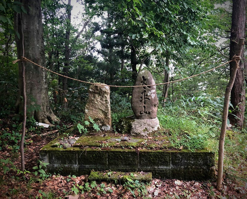
Don’t Forget your Yamabushi Spirit: The summit of Sabane-yama

Jizo-do is certainly a destination in and of itself. However, if you want to reach the real summit of Sabane-yama, keep following the narrow forest road. Soon enough, on your left, you will find a bush where the actual summit lies.
Getting there requires a bit of effort, though, as the path is not exactly cleared regularly. In other words, make sure to bring your Yamabushi climbing spirit!
Getting back
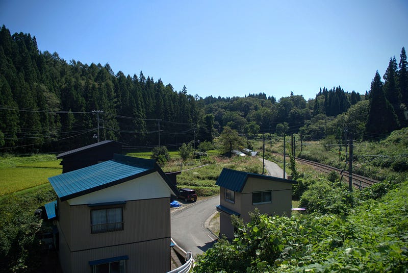
Then it’s just a matter of retracing your steps. Or, you can take the same road where the Rekishi Minzoku Shiryokan is right back to the station. To do so, follow the road down the hill. Take a right at the shrine gates next to the tunnel. Then take a left at the Family Mart. You’ll soon find yourself back in the residential area you started in.
Sabane-yama and the Forgotten Highway of Japan
It’s hard to appreciate just how important Sabane-yama was when you’re traveling through it at the speed limit. Sabane-yama’s ancient trails are still relatively intact. There is an outstanding temple at the summit with amazing views to top it off. Plus, that this unsuspecting mountain was a core point along one of the most significant routes in the history of Japan just proves why every once in a while, we should make a point of taking the slow route.
In short: Sabane-yama is famous for:
- Historic trails on the Ushu Kaido, part of The Edo Five Routes, or the forgotten highways of Japan
- Jizo-do, a Zen temple with spectacular views over the Mogami River
- Crossings by many famous people, including Daimyo, Haiku poets, and British authors
- Low-lying mountain whose summit is reachable by car and boasts spectacular views over the Mogami River, Gassan, and Murayama Hayama
Nearby locations worth checking out
Ginzan Onsen
Sabane-yama is only a short 30-minute drive from Ginzan Onsen, one of the most well-known parts of Yamagata Prefecture. Famous for its Ryokan along a river straight out of a Ghibli film, Ginzan Onsen is an excellent location to relax your aches and pains.
Switch-on coffee
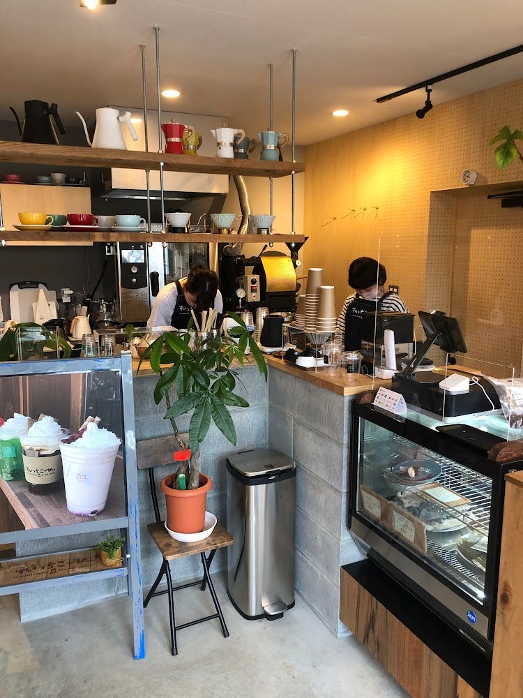
One day, I was passing through Obanazawa on my way home from Sendai. I found this cool little café had only recently opened. They had amazing cheesecakes, and their selection of beans was also rather extensive, something for everyone. The master there really knew his stuff too! A great little spot to visit.
Mogami River
The 229km Mogami River running the length of Yamagata Prefecture is the 7th longest river in Japan. It is also the longest contiguous river in one prefecture. It takes 3 to 5 days for the water to flow from the source to the ocean. Along with the Fuji river in Yamanashi and Shizuoka Prefectures, and the Kuma River in Kumamoto, the Mogami is one of the big three fastest-flowing rivers in Japan.
The Mogami River featured prominently in Matsuo Basho’s The Narrow Road to the Deep North. Matsuo Basho and his trusty partner Kawai Sore stayed three days in Oishida. Once they had good weather, they travelled to the Dewa Sanzan, boarding the Mogami River in the area right in front of Yamuki-yama.
This river voyage inspired the following haiku by Matsuo Basho:
Gathering the rains
Of summer, how swift she runs
Mogami River
Matsuo Basho
The Sakura of Kita-yama

Kita-yama is a converted ski field in the Murayama region of Yamagata prefecture. Kita-yama (北山きたやま) is the perfect spot for a picnic among the Sakura. The mountain offers panoramic views over the rice fields and mountains of inland Yamagata Prefecture.
Okina-san: Venerable Old Man Mountain

Venerable Old Man Mountain Okina-san (翁山おきなさん, Mt. Okina) lies along The Ou Mountains. The landscapes and legends of Okina-san (翁山おきなさん, Mt. Okina) make this 1075 m (3526 ft.) peak not only a 100 Famous Mountain of Yamagata, but also one of the 100 Famous Mountains of Tohoku.
Futatsu-mori
The twin-peaked Futatsu-mori (二ツ森ふたつもり) is a 742 m (2,434 ft.) peak in the Murayama region of Yamagata Prefecture. Futatsu-mori is best climbed from late May to mid-November. The mountain is a level 1 in terms of physical demand, which means it is easy to hike. The mountain has an A technical grade, which means it requires little expertise. Allow at least one hour one-way for a climb up Futatsu-mori.
SABANE-YAMA
猿羽根山 | さばねやま
Mt. Sabane, Mt. Sabaneyama, Mt. Sabane-yama
Sabane-yama (猿羽根山さばねやま) is a 160m (524. ft.) peak in the Mogami and Murayama regions of Yamagata prefecture best climbed from June to October. Allow at least 3 hours for a climb up Sabane-yama.
Mountain Range
Sabane-yama
Region
Mogami, Murayama
Elevation
160m (524. ft.)
Technical Demand
Unknown
Physical Demand
Unknown, but you can drive to the summit if you want.
Trails
1) Sabane-yama Trail (1 hour 20 one-way)
Best time to climb
June to October
Day trip possible?
Yes
Minimum Time Required
2 hours 40
PDF Maps by TheHokkaidoCartographer and JapanWilds.org. See all here.


YAMABUSHI NEWSLETTER
KIWI YAMABUSHI

TIM BUNTING - KIWI YAMABUSHI