PREVIOUSNEXT
How NOT to climb a mountain in winter
しろたろうやま
白太郎山
SHIROTARO-YAMA
Forget Hakuba. Forget Hokkaido. White-Boy Mountain is where it’s at.
Some background:
This winter, I climbed three mountains here in Yamagata, north Japan. One in particular, Shirotaro-yama, was an especially tough climb that didn’t end as expected. If you get the chance, I highly recommend checking out this peak, but before you do, be sure to read on so that you don’t make the same mistakes on winter mountains I did.
The last rule applies to climbing any mountain, and is arguably the most important!
Forget Hakuba.
Forget Hokkaido.
Like a cocaine addict, Shirotaro-yama is not itself until it snows. Tucked away deep in the mountains of Yamagata, Shirotaro-yama is the winter wonderland of your dreams.
Only it’s real.
Even the name is real. Shiro (white) taro (boy) yama (mountain).
White boy mountain.
When all around you turns to white and the snow starts creeping in through the windows, you’ll know it’s time.
Time to climb Shirotaro-yama.
And climb it we did.
Or tried to, at least.
I usually write guides about how to climb mountains. But in the case of Shirotaro-yama, well, let’s just say it nearly made a white boy out of me.
Nearly.
There were quite a few things we (I) learned in the process I think you should know.
So, here’s the Kiwi Yamabushi guide to:
How NOT to climb a mountain in winter (FEAT. Shirotaro-yama)
Rule number one: Know the Climbing Season
First up, know the climbing season. If you try to climb Shirotaro-yama any time that is not snowy, you’re going to have a bad time. The white stuff is precisely why we can climb Shirotaro-yama in the first place.
Shirotaro-yama is in Oguni-machi in the Okitama region of Yamagata, my first mountain in the region on the 100 Famous Mountains of Yamagata list. This region is known for its deep, deep snow.
Try in the warmer months and not only will you be sorely disappointed, you will be disappointedly sore. The mountain is covered in bush so thick it would take a flamethrower to have any chance of getting through. In other words, Shirotaro-yama is only accessible when there has been ample snowfall, usually December to March.
So, you may be thinking, if the mountain is only climbable when there is snowfall, how do you know where the path is?
Long story short,
You don’t.
This means you need to follow:
Rule number two: Get yourself a Guide
Really the only way to climb Shirotaro-yama is to go with a guide. Or rather, as anyone with experience snowshoeing knows, a group. The reasons for this will soon become obvious.
We joined a hike run by Yamagata Arcadia who go there every winter, something I’d recommend you do too. And get this, our guide wasn’t an older Japanese dude like I expected.
He was Swiss!
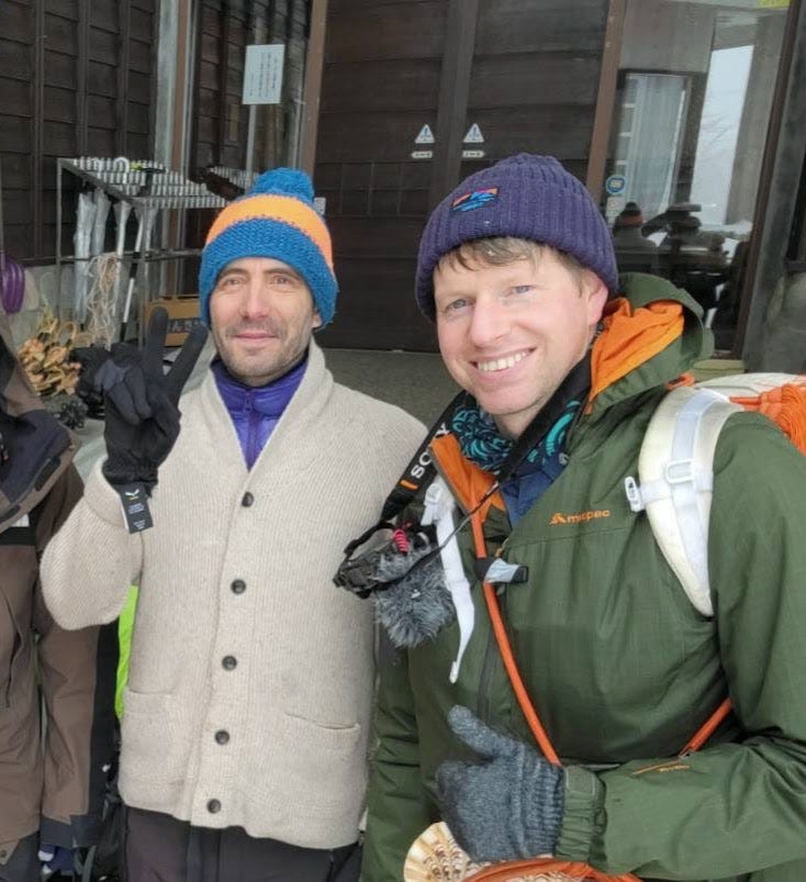
Cédric, as he is affectionately known, moved to Oguni-machi about five years ago with his wife who runs a cafe, Naebaco. Originally I thought Cédric moved to the region because of “Tohoku’s Matterhorn” nearby, Iwaigame-yama.
Apparently not.
Cédric lied and said he knew of the mountain, but had no idea of its moniker.
Either way, Cédric was an inspirational guy. He runs all sorts of outdoor adventures in and around Oguni, and I have already signed up for one in summer. Since Cédric speaks English, French, and Japanese, it would be possible for you to join as well. And from our experience on Shirotaro-yama, I’d highly recommend it!
There we were standing outside the meeting spot, a place called Rifure, in the freezing cold. The five of us gave our introductions, though not before I asked if Cedric knew the origin of the name Shirotaro-yama. He snapped back with ‘climb it. You’ll soon find out’.
And find out, I did.
Well, mainly because of:
Rule Number Three: Follow the Guide.
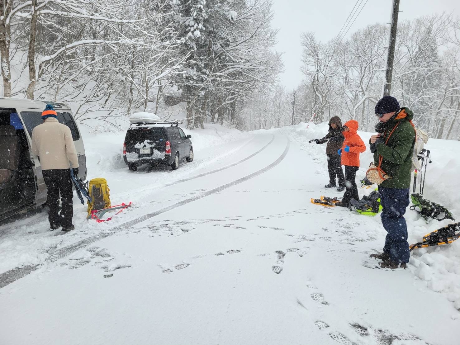
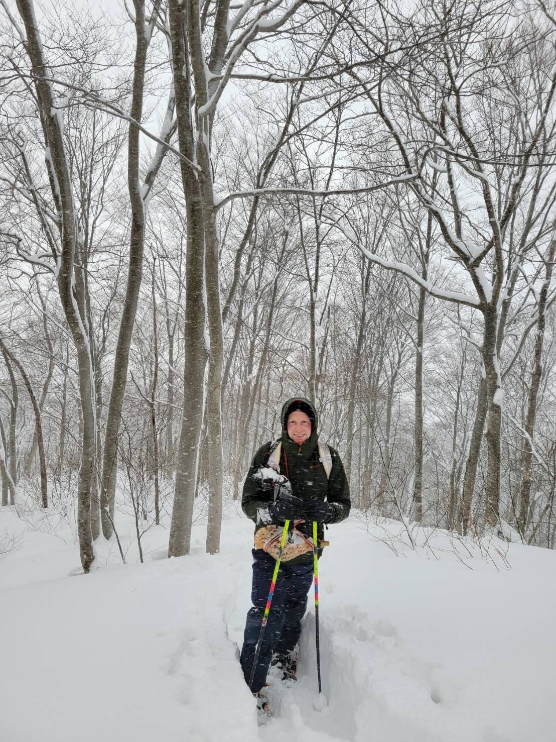
I wish I had a photo. Cédric’s van had a switch saying ‘diesel or Tempura fat’. Swiss engineering at its best! We piled in the back. With the snowshoeing gear it was a bit of a tight squeeze, but we got there in the end.
When we got out, Cédric took us back down the road a little to put our snowshoeing gear on. If we had climbed up from where we parked our car, right from the start we would have had to cross a small-yet-large-enough-to-be-annoying river. The kind of thing that means you’re going to have a bad time, and the exact reason why you get a guide.
However, before that, you should probably follow:
Rule Number Four: Know Your Gear
I wanted to film the experience, so I attached a camera to my shoulder strap. I also got out my gimbal to attach my phone to and get some footage.
It wasn’t long until I realised neither of these things were a good idea. If you try to film in especially snowy conditions, you’re going to have a bad time.
To make matters worse…
This was also the point I realised my brand new snow gloves were slightly too small. Not enough that I couldn’t force them on, but enough that it took longer than it should. When you’re outside in the cold, this gets much harder to do. So hard, in fact, at times it was better not to wear them.
Like every time I tried to use my camera or the gimbal.
20 minutes or so in, I noticed the camera on my shoulder was completely covered in snow. I had the lens cap on, but it would be a mission just to get a few shots that I could just get with my phone. If it wasn’t too cold, of course.
In the end it was fine. I hadn’t intended on doing anything too drastic with that camera, it was there as a back up. So;
Into my bag it went.
A bit of added weight, what’s to worry about?
But then, another even more pressing issue became apparent.
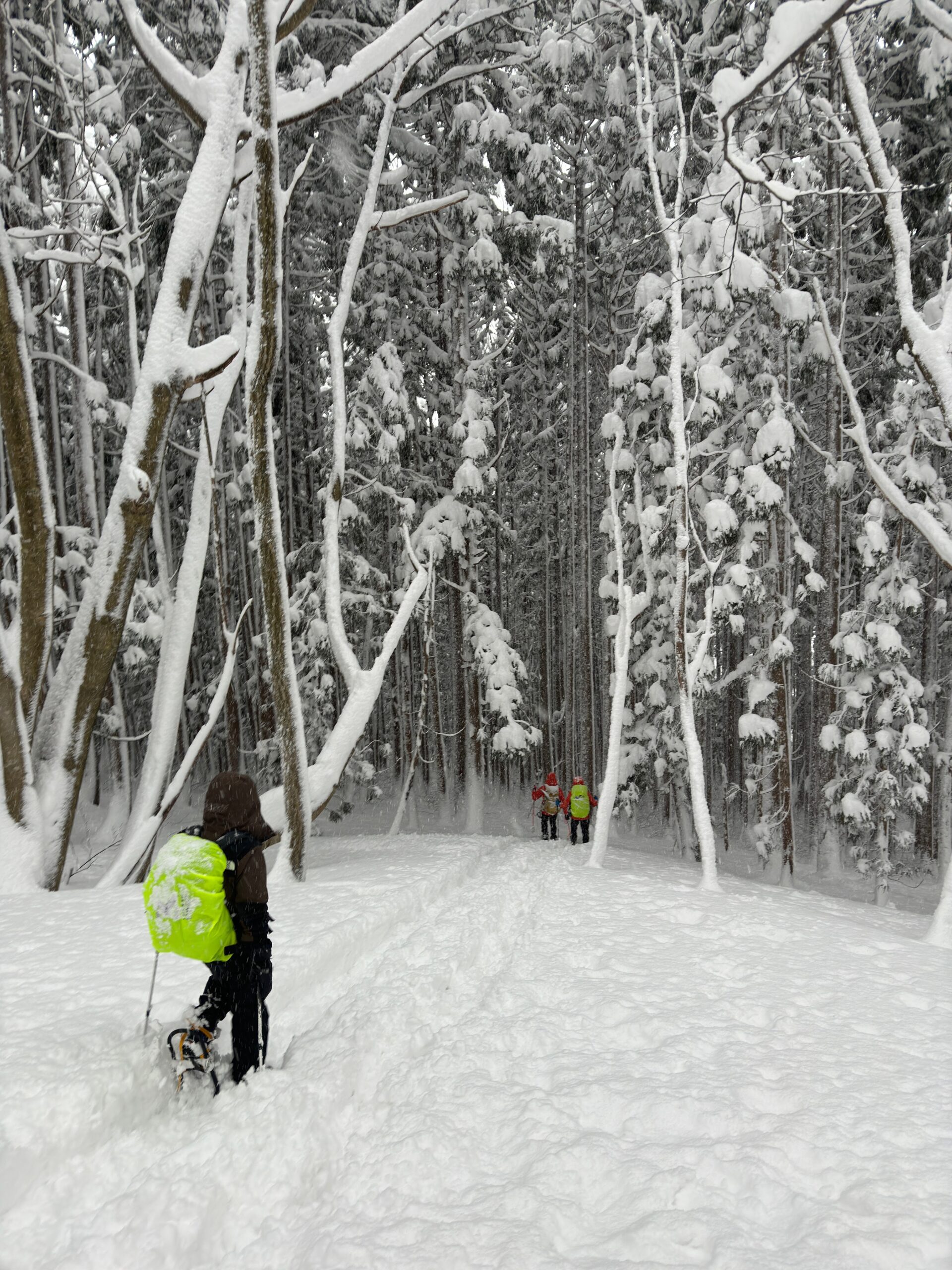
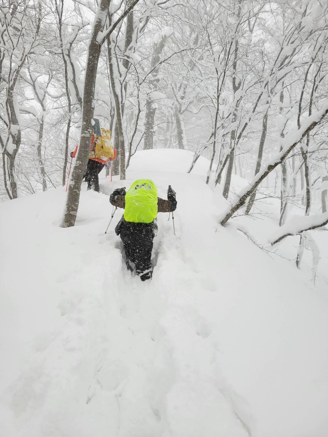
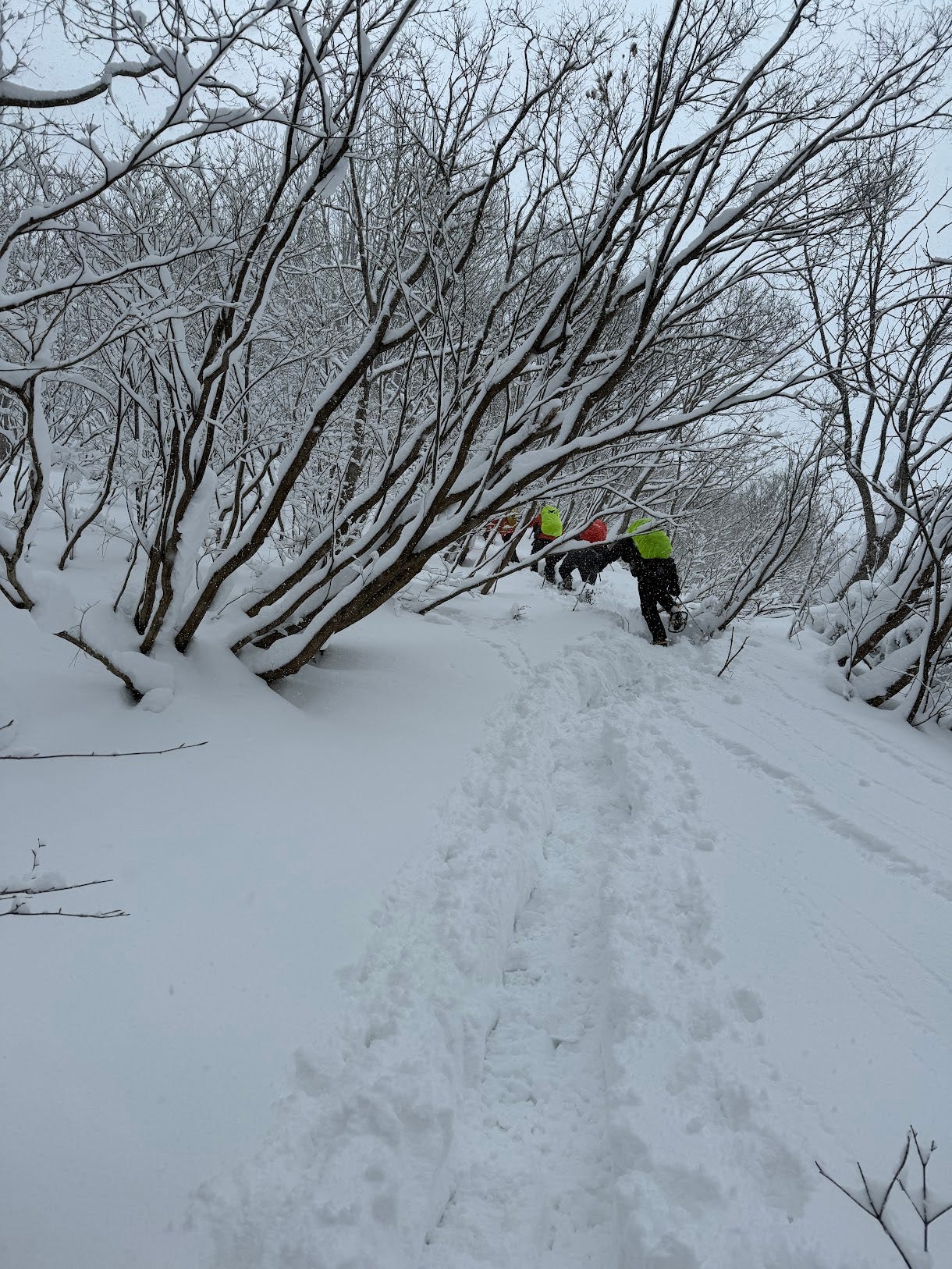
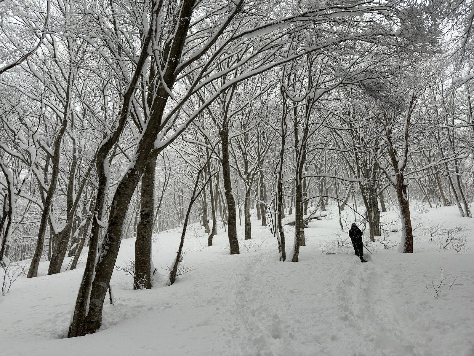
We established that Shirotaro-yama is famous for snow. Let me tell you, on the day there was so much snow it was coming out my eyeballs. If you’re prepared, it’s no problem. You just go ahead as per usual. However, if you find halfway up the mountain the snowshoes you were wearing were more for flat land, well, you’re going to have a bad time.
Part of me wishes I had followed:
Rule Number Five: Bring as Many People as Realistically Possible
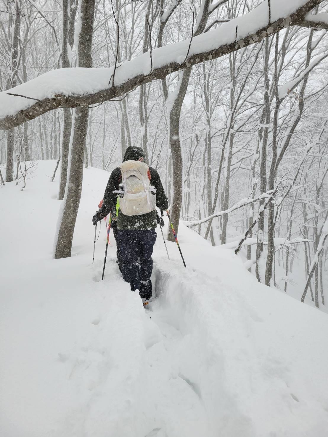
When you climb snowy peaks, it makes sense to take turns leading the pack. It’s a lot of effort to break the snow and create a path to be able to get anywhere. This is why snowshoeing is not so bad when you have a big group. You all share the burden of creating a path in the snow, and you have ample rest time as well.
We were a group of five, and the snow was admittedly much deeper than anticipated. In the end, our group proved too small to climb Shirotaro-yama. I’m sure it would have been a different story if we had more people.
But more than that…
The snowshoes.
More than that, if we had brought the right snowshoes, again, it could well have been a different story.
Some snowshoes are built differently. Some are just plain better on steep mountains, the ones that tend to be much smaller. Smaller snowshoes means less surface area. Less surface area means you can more easily get your feet out when the snow inevitably falls into the path you just created. Path creation is essentially what you are there for.
In other words, the snowshoes I had brought weren’t the best for climbing in deep snow. They were the big, wider kind best-suited for flatter snow. Since we were a smaller group, this undoubtedly slowed us down.
This didn’t mean we didn’t try, however.
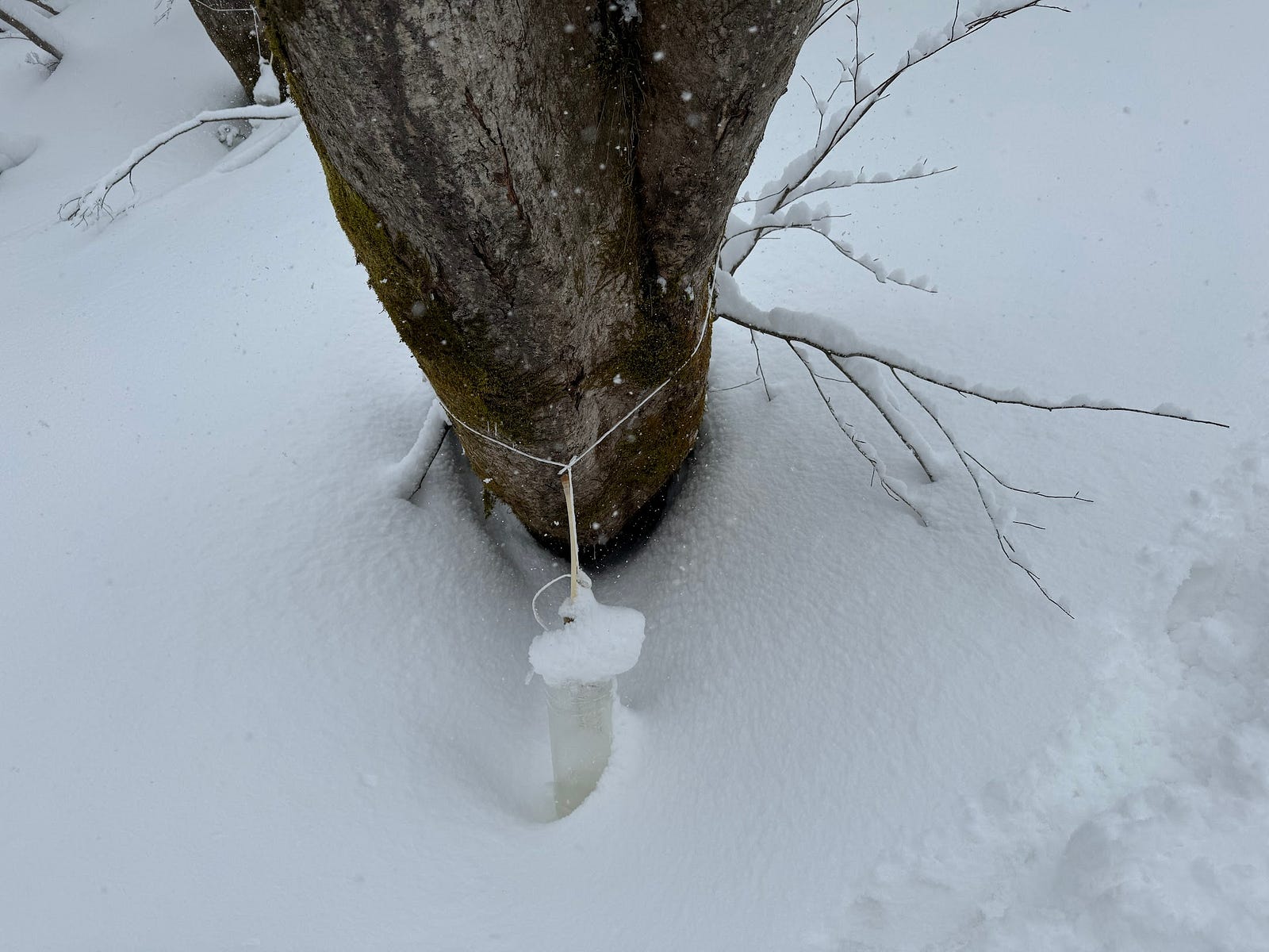
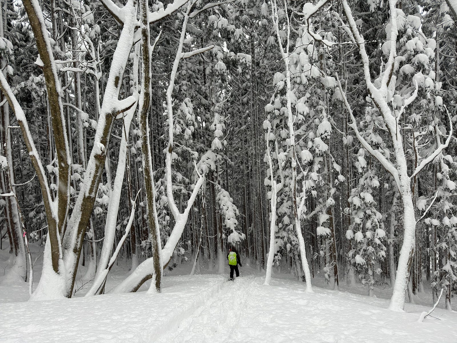
Cédric took one for the team and was first to create our path through the snow. We passed a few trees with what looked like IV drips coming out of them, maple syrup! Or whatever syrup the trees provide. And before long, we made it to the edge of a cedar forest, our first pit stop.
And definitely not our last.
We kept going for quite a while. Each person took turns to create a path in the snow, probably about 20m at a time, more if it was flat. After about an hour or so Cédric informed us we were only a quarter of the way.
I could tell we weren’t making good time.
Eventually, though, we made it to a small dip in the mountains, and had lunch.
Which reminds me of:
Rule number Six: Which is Basically Rule Number Four: Bring the Right Gear.
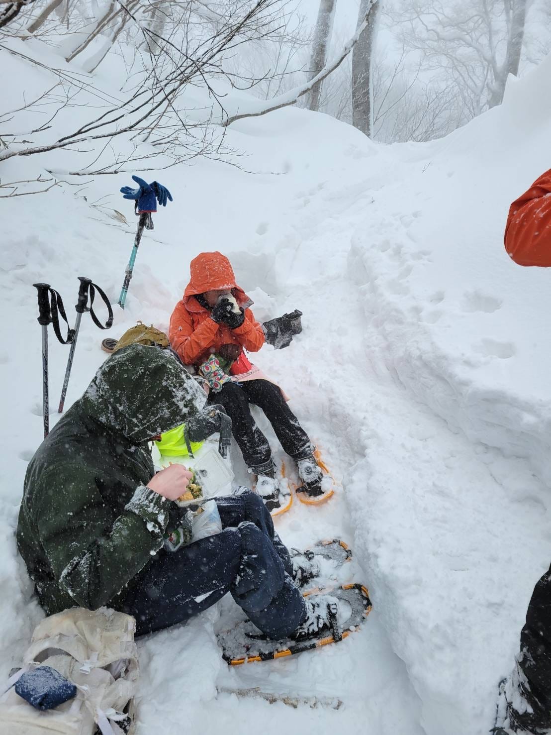
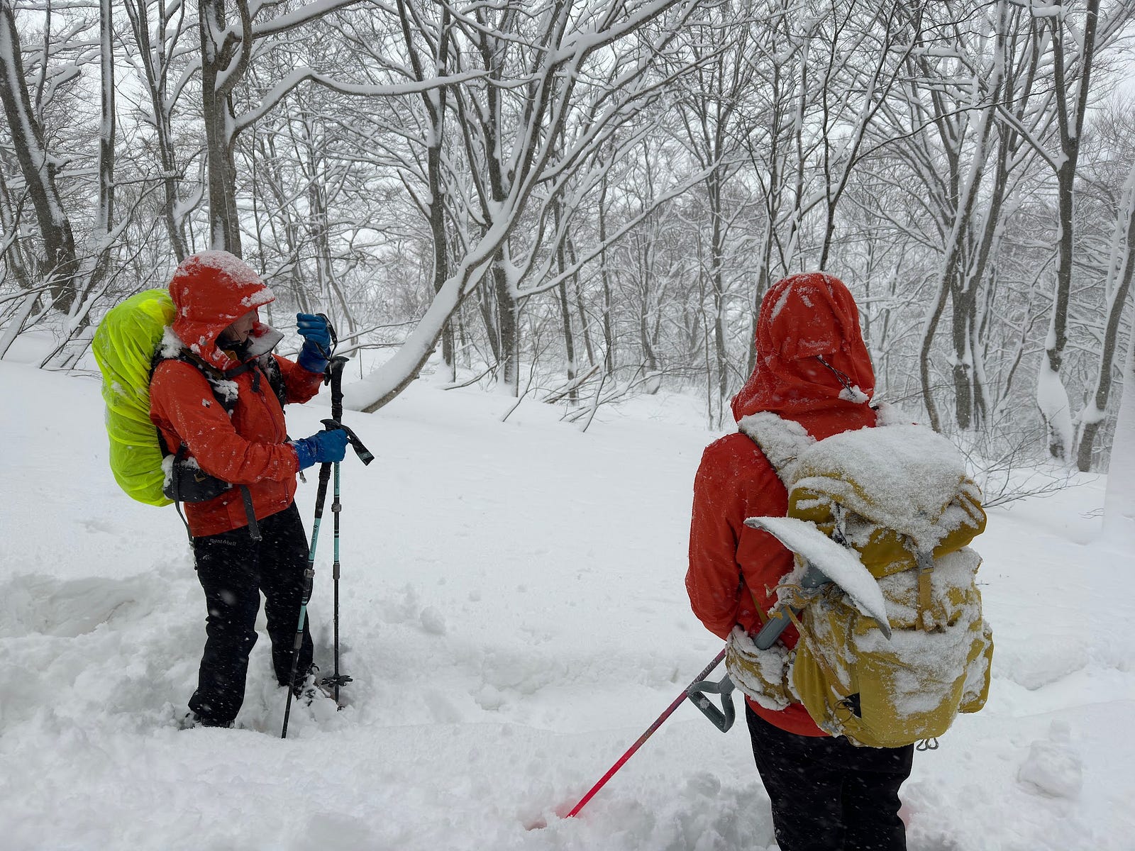
No, I didn’t forget my lunch. You should always have extra food with you on the mountains. I had a nice Obento set, a few onigiri and some pickles. I also had plenty of hot water in my Platypus water bladder (I didn’t realise you could put boiled water in them until I did my mountain first aid course recently).
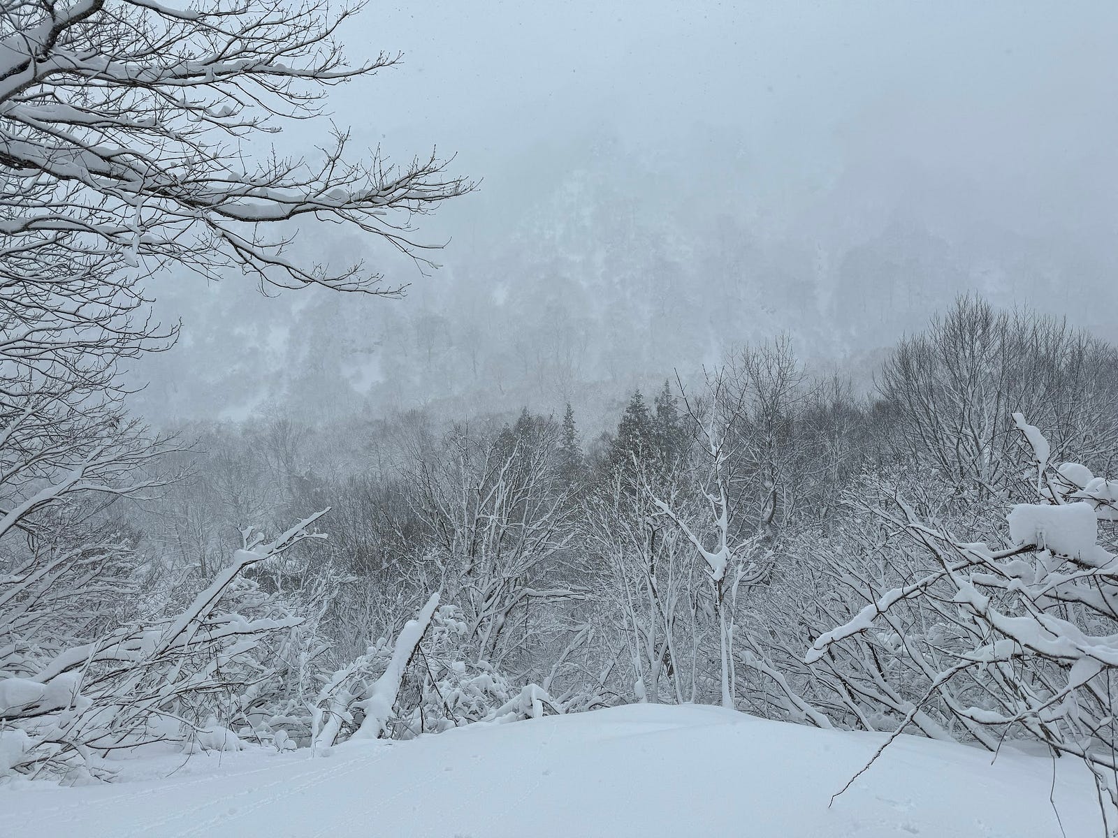
At this point, it was already much later than anticipated. Cédric asked us whether we would be ok to continue on to the summit, which was at least another hour away. Even if we got there, we knew the visibility wouldn’t be that great, but we were so close we decided to go for it.
Until,
About 10 minutes after we started climbing again, I realised I couldn’t feel my hands. Well, I had realised right after lunch, basically as soon as I stopped holding the aforementioned boiling water (through a towel).
Naturally, this only kept my hands warm when my hands were in my bag. In case you don’t know, hands in your bag the whole way is not exactly conducive to climbing mountains.
So, I told Cédric, who made the executive decision to turn around.
The summit of Shirotaro-yama is 1003m (3290 ft.) above sea level. When I checked the stats, after the fact of course, we had made it to 900m (2953 ft.) of elevation. We were so close to the summit, but in reality, we were still far.
Which is all just a good reminder of:
The Last Rule: Getting to the summit is but one part of it
When it comes to mountains, it’s always best to err on the side of caution.
In the end my gloves meant we had to turn around. Well, that and a few other things, but still. If I had had proper fitting gloves, my hands wouldn’t have gotten so cold, and we may well have made it to the summit.
An important reminder that getting to the summit is but one part of climbing mountains. If that’s your only goal, well, you need to pick a different hobby. Either way, the mountains should eventually teach you that. Letting your ego get the best of you is a recipe for disaster when it comes to the outdoors.
And that’s how I learned the meaning of White Boy Mountain.
Shirotaro-yama Trail (winter only, 3 hours one-way, bring experienced winter hiker)
Since there are no trails in the summer, the only time you can go is when snow has settled on the mountain in winter. Since it’s hard to know where to go, you MUST go with someone experienced with snow hiking. You will need Kanjiki, snowshoes, and stocks? Plus, since it takes a lot of energy to create a trail, you should change the lead hiker periodically. On the way back, by all means use a sleigh or other methods to reduce the time necessary on the mountain.
The road to the trailhead is paved. There is space for about 4 vehicles 60 m from the trailhead, but no parking in front of the houses.
Places nearby to check out
Tohoku's Matterhorn
Iwaigame-yama (祝瓶山いわいがめやま) is a 1417m (4648 ft.) peak in the Murayama region of Yamagata prefecture at the southern edge of the Asahi Renpo. The mountain's shape resembles that of The Matterhorn. Climbing season for Iwaigame-yama is usually from June to October. Iwaigame-yama is a level 3 in terms of physical demand, which means it is moderate to hike, has a B technical grade, which means it doesn’t require too much expertise, and you want to allow at least 7 hours for a hike.
Oasahi-dake
The main peak along the Asahi Renpo, and also one of the 100 Famous Mountains of Japan, Oasahi-dake (大朝日岳おおあさひだけ) is a 1871m (6138 ft.) peak along the borders of the Okitama, Murayama, and Shonai regions of Yamagata. Oasahi-dake is a level 5 in terms of physical demand, which means it is hard to hike. The mountain has a B technical grade. This means it doesn’t require too much expertise. Allow at least 12 hours for a climb up Oasahi-dake, meaning you probably need to stay on the mountain.
Todono-san
Lying along the borders of Shirataka and Asahi Towns, Todono-san is a 1203m (3946 ft.) peak that was part of the ancient trails to Yudono-san. Best climbed from June to October, Todono-san is a level 3 in terms of physical demand, which means it is moderate to hike. The mountain has a B technical grade, which means it doesn’t require too much expertise. Allow at least 4 hours for a climb up Todono-san.
SHIROTARO-YAMA
白太郎山 | しろたろうやま
Mt. Shirotaro, Shirotaroyama, Mt. Shirotaroyama
Shirotaro-yama (白太郎山しろたろうやま) is a 1003m (3290 ft.) peak in the Okitama Region of Yamagata prefecture. Shirotaro-yama is only open during snow season from January to March. Allow at least 2 hours for a climb.
Mountain Range
Shirotaro-yama
Region
Okitama
Elevation
1003m (3290 ft.)
Technical Demand
Bring someone with experience hiking on snow.
Physical Demand
Walking on snow, so high.
Trails
One: Shirotaro-yama Trail (winter only, 3 hours one-way, bring experienced winter hiker)
Best time to climb
January to March
Day trip possible?
Yes
Minimum Time Required
3 hours one-way on the Shirotaro-yama Trali
PDF Maps by TheHokkaidoCartographer and JapanWilds.org. See all here.


YAMABUSHI NEWSLETTER
KIWI YAMABUSHI

TIM BUNTING - KIWI YAMABUSHI